
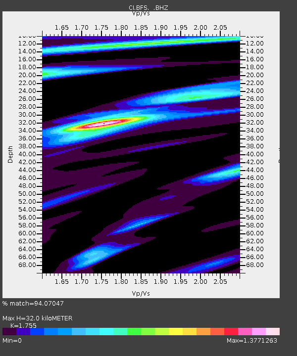
BFS Mt Baldy Forest Station - Earthquake Result Viewer
| ||||||||||||||||||
| ||||||||||||||||||
| ||||||||||||||||||
|
Signal To Noise
| Channel | StoN | STA | LTA |
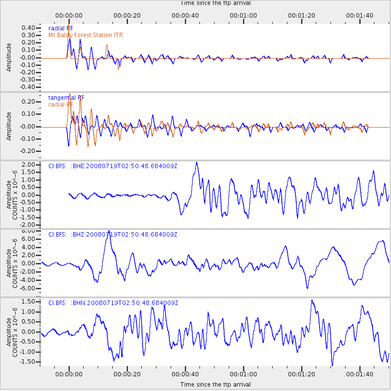
| CI:BFS: :BHZ:20080719T02:50:48.684009Z | 1.8961443 | 6.074453E-7 | 3.2035817E-7 |
| CI:BFS: :BHN:20080719T02:50:48.684009Z | 1.4025358 | 1.6129219E-7 | 1.15000404E-7 |
| CI:BFS: :BHE:20080719T02:50:48.684009Z | 1.747882 | 1.5791205E-7 | 9.03448E-8 |
| Arrivals | |
| Ps | 4.0 SECOND |
| PpPs | 14 SECOND |
| PsPs/PpSs | 18 SECOND |

