You are here: Home > Network List > TA - USArray Transportable Network (new EarthScope stations) Stations List
> Station 109C Camp Elliot, Mirimar, CA, USA > Earthquake Result Viewer
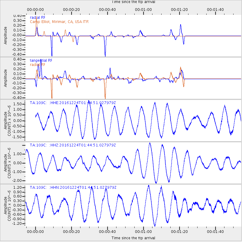
109C Camp Elliot, Mirimar, CA, USA - Earthquake Result Viewer
*The percent match for this event was below the threshold and hence no stack was calculated.
| Earthquake location: |
New Ireland Region, P.N.G. |
| Earthquake latitude/longitude: |
-5.2/153.6 |
| Earthquake time(UTC): |
2016/12/24 (359) 01:32:15 GMT |
| Earthquake Depth: |
29 km |
| Earthquake Magnitude: |
5.8 Mwp |
| Earthquake Catalog/Contributor: |
NEIC PDE/us |
|
| Network: |
TA USArray Transportable Network (new EarthScope stations) |
| Station: |
109C Camp Elliot, Mirimar, CA, USA |
| Lat/Lon: |
32.89 N/117.11 W |
| Elevation: |
150 m |
|
| Distance: |
92.2 deg |
| Az: |
57.344 deg |
| Baz: |
265.302 deg |
| Ray Param: |
$rayparam |
*The percent match for this event was below the threshold and hence was not used in the summary stack. |
|
| Radial Match: |
72.179214 % |
| Radial Bump: |
159 |
| Transverse Match: |
58.15788 % |
| Transverse Bump: |
400 |
| SOD ConfigId: |
11737051 |
| Insert Time: |
2019-04-26 10:26:35.067 +0000 |
| GWidth: |
2.5 |
| Max Bumps: |
400 |
| Tol: |
0.001 |
|
Signal To Noise
| Channel | StoN | STA | LTA |
| TA:109C: :HHZ:20161224T01:44:51.027979Z | 0.7518533 | 8.033219E-7 | 1.0684556E-6 |
| TA:109C: :HHN:20161224T01:44:51.027979Z | 2.54197 | 5.6524124E-7 | 2.2236345E-7 |
| TA:109C: :HHE:20161224T01:44:51.027979Z | 1.8344178 | 1.2942608E-6 | 7.05543E-7 |
| Arrivals |
| Ps | |
| PpPs | |
| PsPs/PpSs | |


