BFS Mt Baldy Forest Station - Earthquake Result Viewer
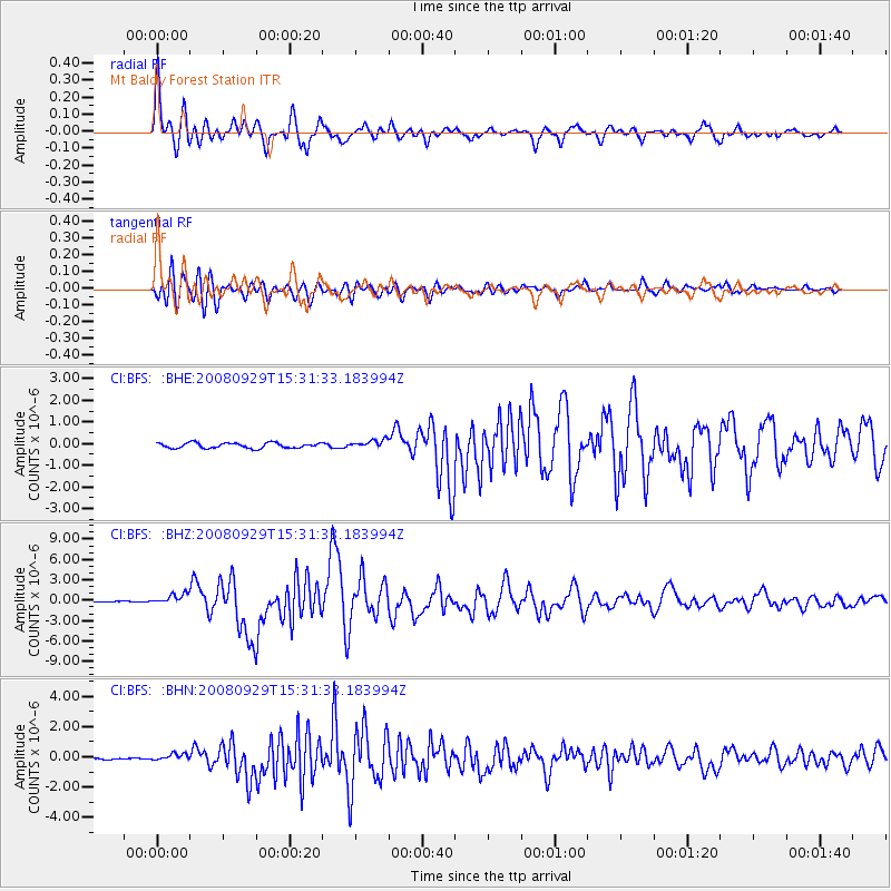
Earthquake location: Kermadec Islands, New Zealand
Earthquake latitude/longitude: -29.8/-177.7
Earthquake time(UTC): 2008/09/29 (273) 15:19:31 GMT
Earthquake Depth: 36 km
Earthquake Magnitude: 6.5 MB, 6.7 MS, 7.0 MW, 7.0 MW
Earthquake Catalog/Contributor: WHDF/NEIC
Network: CI Caltech Regional Seismic Network
Station: BFS Mt Baldy Forest Station
Lat/Lon: 34.24 N/117.66 W
Elevation: 1312 m
Distance: 85.2 deg
Az: 46.066 deg
Baz: 229.104 deg
Ray Param: 0.044873036
Estimated Moho Depth: 42.75 km
Estimated Crust Vp/Vs: 2.07
Assumed Crust Vp: 6.276 km/s
Estimated Crust Vs: 3.028 km/s
Estimated Crust Poisson's Ratio: 0.35
Radial Match: 94.01841 %
Radial Bump: 400
Transverse Match: 84.62464 %
Transverse Bump: 400
SOD ConfigId: 2560
Insert Time: 2010-03-05 20:52:52.903 +0000
GWidth: 2.5
Max Bumps: 400
Tol: 0.001

Signal To Noise

ChannelStoNSTALTA
CI:BFS: :BHZ:20080929T15:31:33.183994Z5.25690367.767169E-71.4775179E-7
CI:BFS: :BHN:20080929T15:31:33.183994Z3.13532332.2479114E-77.169632E-8
CI:BFS: :BHE:20080929T15:31:33.183994Z1.61150381.9771382E-71.2268902E-7
Arrivals
Ps7.5 SECOND
PpPs21 SECOND
PsPs/PpSs28 SECOND