BFS Mt Baldy Forest Station - Earthquake Result Viewer
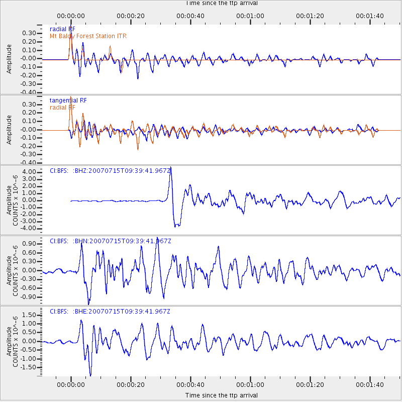
Earthquake location: Vanuatu Islands
Earthquake latitude/longitude: -15.4/168.6
Earthquake time(UTC): 2007/07/15 (196) 09:27:34 GMT
Earthquake Depth: 8.0 km
Earthquake Magnitude: 6.0 MB, 5.8 MS, 6.1 MW, 6.0 MW
Earthquake Catalog/Contributor: WHDF/NEIC
Network: CI Caltech Regional Seismic Network
Station: BFS Mt Baldy Forest Station
Lat/Lon: 34.24 N/117.66 W
Elevation: 1312 m
Distance: 85.6 deg
Az: 52.906 deg
Baz: 248.241 deg
Ray Param: 0.044624288
Estimated Moho Depth: 18.5 km
Estimated Crust Vp/Vs: 1.61
Assumed Crust Vp: 6.276 km/s
Estimated Crust Vs: 3.892 km/s
Estimated Crust Poisson's Ratio: 0.19
Radial Match: 89.76682 %
Radial Bump: 400
Transverse Match: 81.88714 %
Transverse Bump: 400
SOD ConfigId: 2564
Insert Time: 2010-03-05 20:53:31.562 +0000
GWidth: 2.5
Max Bumps: 400
Tol: 0.001

Signal To Noise

ChannelStoNSTALTA
CI:BFS: :BHN:20070715T09:39:41.967Z6.94482663.3564774E-74.833062E-8
CI:BFS: :BHE:20070715T09:39:41.967Z9.5445715.426592E-75.6855278E-8
CI:BFS: :BHZ:20070715T09:39:41.967Z46.2825661.9502218E-64.2137284E-8
Arrivals
Ps1.9 SECOND
PpPs7.5 SECOND
PsPs/PpSs9.4 SECOND