
BFS Mt Baldy Forest Station - Earthquake Result Viewer
| ||||||||||||||||||
| ||||||||||||||||||
| ||||||||||||||||||
|
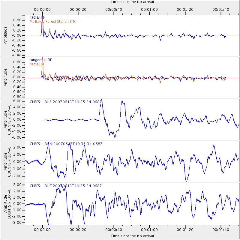
Signal To Noise
| Channel | StoN | STA | LTA |
| CI:BFS: :BHN:20070613T19:35:34.068Z | 8.457999 | 1.1948479E-6 | 1.4126839E-7 |
| CI:BFS: :BHE:20070613T19:35:34.068Z | 10.926948 | 1.5025295E-6 | 1.3750679E-7 |
| CI:BFS: :BHZ:20070613T19:35:34.068Z | 17.912409 | 3.0645795E-6 | 1.7108695E-7 |
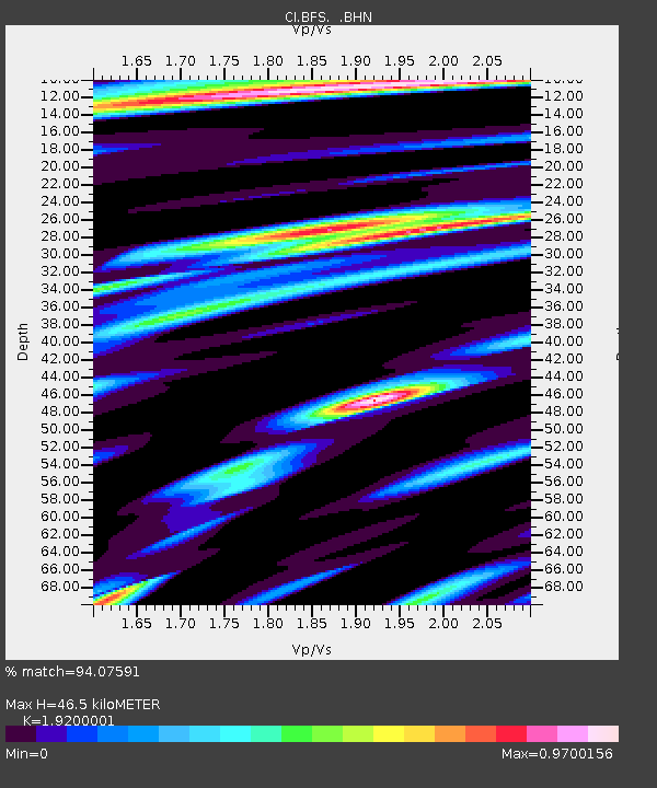
| Arrivals | |
| Ps | 7.3 SECOND |
| PpPs | 20 SECOND |
| PsPs/PpSs | 27 SECOND |

