BFS Mt Baldy Forest Station - Earthquake Result Viewer
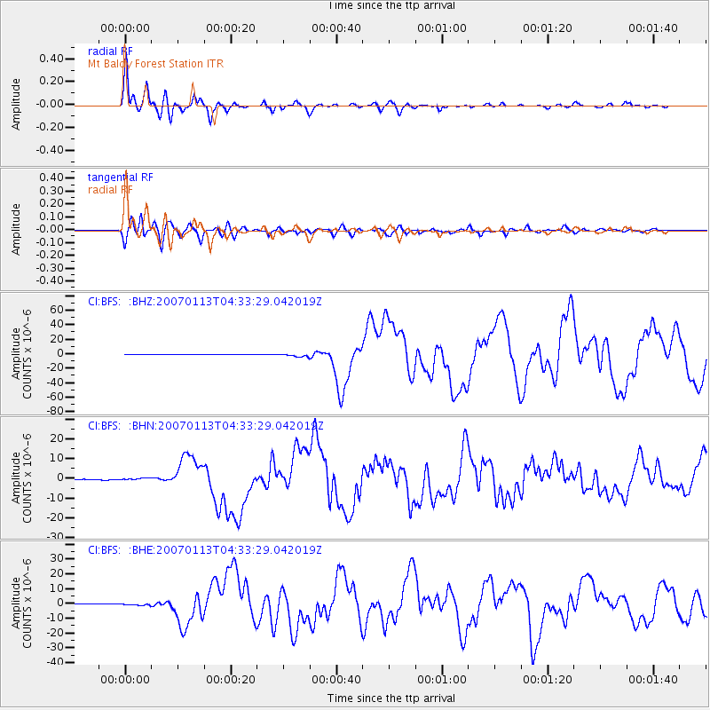
Earthquake location: East Of Kuril Islands
Earthquake latitude/longitude: 46.2/154.5
Earthquake time(UTC): 2007/01/13 (013) 04:23:21 GMT
Earthquake Depth: 10 km
Earthquake Magnitude: 7.3 MB, 8.2 MS, 8.1 MW, 7.9 MW
Earthquake Catalog/Contributor: WHDF/NEIC
Network: CI Caltech Regional Seismic Network
Station: BFS Mt Baldy Forest Station
Lat/Lon: 34.24 N/117.66 W
Elevation: 1312 m
Distance: 64.8 deg
Az: 66.151 deg
Baz: 309.986 deg
Ray Param: 0.058663275
Estimated Moho Depth: 30.5 km
Estimated Crust Vp/Vs: 1.80
Assumed Crust Vp: 6.276 km/s
Estimated Crust Vs: 3.491 km/s
Estimated Crust Poisson's Ratio: 0.28
Radial Match: 97.362946 %
Radial Bump: 374
Transverse Match: 91.358 %
Transverse Bump: 400
SOD ConfigId: 2564
Insert Time: 2010-03-05 20:53:48.642 +0000
GWidth: 2.5
Max Bumps: 400
Tol: 0.001

Signal To Noise

ChannelStoNSTALTA
CI:BFS: :BHN:20070113T04:33:29.042019Z4.2928215.838632E-71.3600922E-7
CI:BFS: :BHE:20070113T04:33:29.042019Z6.06966077.475731E-71.2316555E-7
CI:BFS: :BHZ:20070113T04:33:29.042019Z10.306542.3597775E-62.2895922E-7
Arrivals
Ps4.0 SECOND
PpPs13 SECOND
PsPs/PpSs17 SECOND