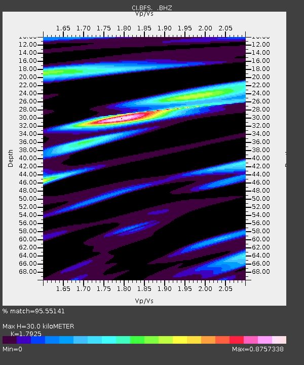
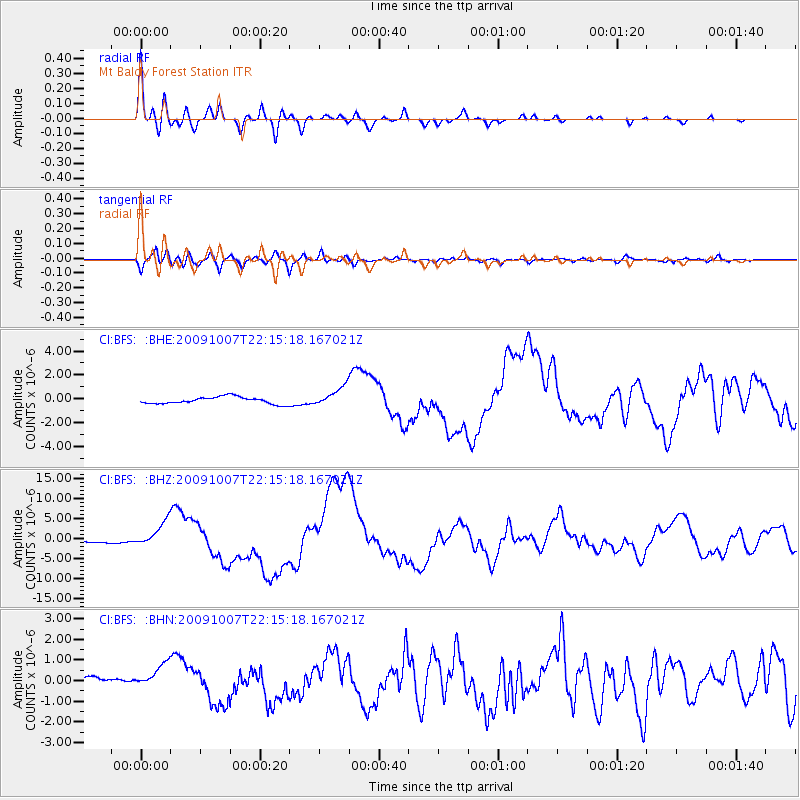
BFS Mt Baldy Forest Station - Earthquake Result Viewer

Earthquake location: Vanuatu Islands
Earthquake latitude/longitude: -13.0/166.5
Earthquake time(UTC): 2009/10/07 (280) 22:03:14 GMT
Earthquake Depth: 45 km
Earthquake Magnitude: 6.4 MB, 7.3 MS, 7.6 MW, 7.7 MW
Earthquake Catalog/Contributor: WHDF/NEIC
Network: CI Caltech Regional Seismic Network
Station: BFS Mt Baldy Forest Station
Lat/Lon: 34.24 N/117.66 W
Elevation: 1312 m
Distance: 85.8 deg
Az: 53.645 deg
Baz: 251.354 deg
Ray Param: 0.04439985
Estimated Moho Depth: 30.0 km
Estimated Crust Vp/Vs: 1.79
Assumed Crust Vp: 6.276 km/s
Estimated Crust Vs: 3.501 km/s
Estimated Crust Poisson's Ratio: 0.27
Radial Match: 95.55141 %
Radial Bump: 400
Transverse Match: 79.13953 %
Transverse Bump: 400
SOD ConfigId: 2622
Insert Time: 2010-03-05 20:54:09.004 +0000
GWidth: 2.5
Max Bumps: 400
Tol: 0.001

Signal To Noise

ChannelStoNSTALTA
CI:BFS: :BHZ:20091007T22:15:18.167021Z10.1027753.1201112E-63.0883706E-7
CI:BFS: :BHN:20091007T22:15:18.167021Z1.85005196.3769704E-73.4469144E-7
CI:BFS: :BHE:20091007T22:15:18.167021Z2.8061338.202228E-72.9229648E-7
Arrivals
Ps3.9 SECOND
PpPs13 SECOND
PsPs/PpSs17 SECOND