
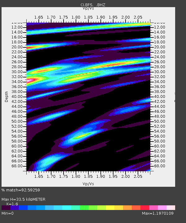
BFS Mt Baldy Forest Station - Earthquake Result Viewer
| ||||||||||||||||||
| ||||||||||||||||||
| ||||||||||||||||||
|
Signal To Noise
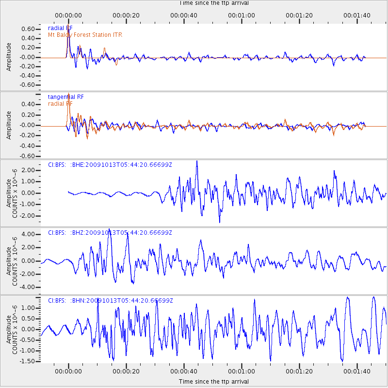
| Channel | StoN | STA | LTA |
| CI:BFS: :BHZ:20091013T05:44:20.66699Z | 3.6156752 | 8.0663773E-7 | 2.2309463E-7 |
| CI:BFS: :BHN:20091013T05:44:20.66699Z | 2.7126448 | 2.3409848E-7 | 8.6298975E-8 |
| CI:BFS: :BHE:20091013T05:44:20.66699Z | 3.4385695 | 3.46563E-7 | 1.0078697E-7 |
| Arrivals | |
| Ps | 3.5 SECOND |
| PpPs | 13 SECOND |
| PsPs/PpSs | 16 SECOND |

