
BFS Mt Baldy Forest Station - Earthquake Result Viewer
| ||||||||||||||||||
| ||||||||||||||||||
| ||||||||||||||||||
|
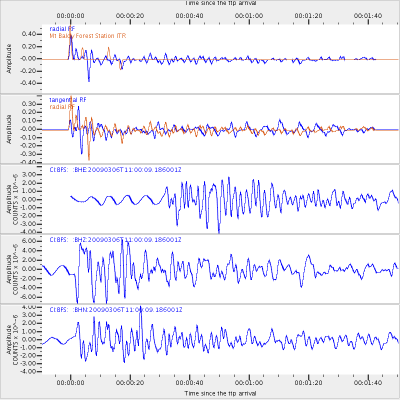
Signal To Noise
| Channel | StoN | STA | LTA |
| CI:BFS: :BHZ:20090306T11:00:09.186001Z | 6.272011 | 3.5639364E-6 | 5.6822864E-7 |
| CI:BFS: :BHN:20090306T11:00:09.186001Z | 4.0384226 | 1.1050876E-6 | 2.7364337E-7 |
| CI:BFS: :BHE:20090306T11:00:09.186001Z | 2.0161645 | 6.8464715E-7 | 3.3957897E-7 |
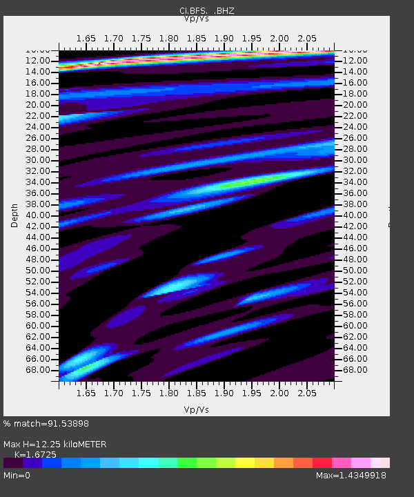
| Arrivals | |
| Ps | 1.4 SECOND |
| PpPs | 5.0 SECOND |
| PsPs/PpSs | 6.4 SECOND |

