You are here: Home > Network List > CI - Caltech Regional Seismic Network Stations List
> Station MPM Manuel Prospect Mine, California, USA > Earthquake Result Viewer
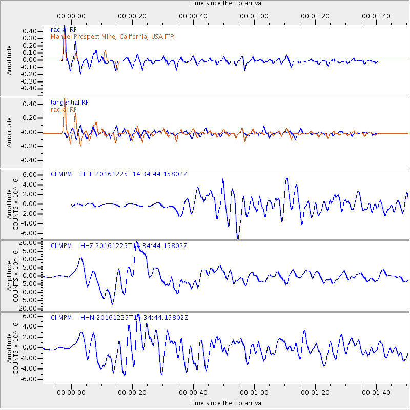
MPM Manuel Prospect Mine, California, USA - Earthquake Result Viewer
*The percent match for this event was below the threshold and hence no stack was calculated.
| Earthquake location: |
Southern Chile |
| Earthquake latitude/longitude: |
-43.3/-74.5 |
| Earthquake time(UTC): |
2016/12/25 (360) 14:22:28 GMT |
| Earthquake Depth: |
15 km |
| Earthquake Magnitude: |
7.7 Mi |
| Earthquake Catalog/Contributor: |
NEIC PDE/at |
|
| Network: |
CI Caltech Regional Seismic Network |
| Station: |
MPM Manuel Prospect Mine, California, USA |
| Lat/Lon: |
36.06 N/117.49 W |
| Elevation: |
185 m |
|
| Distance: |
88.2 deg |
| Az: |
326.441 deg |
| Baz: |
150.128 deg |
| Ray Param: |
$rayparam |
*The percent match for this event was below the threshold and hence was not used in the summary stack. |
|
| Radial Match: |
96.6937 % |
| Radial Bump: |
328 |
| Transverse Match: |
88.72858 % |
| Transverse Bump: |
400 |
| SOD ConfigId: |
11737051 |
| Insert Time: |
2019-04-26 10:37:15.846 +0000 |
| GWidth: |
2.5 |
| Max Bumps: |
400 |
| Tol: |
0.001 |
|
Signal To Noise
| Channel | StoN | STA | LTA |
| CI:MPM: :HHZ:20161225T14:34:44.15802Z | 17.364424 | 6.310817E-6 | 3.634337E-7 |
| CI:MPM: :HHN:20161225T14:34:44.15802Z | 10.111034 | 1.7719324E-6 | 1.752474E-7 |
| CI:MPM: :HHE:20161225T14:34:44.15802Z | 5.722571 | 1.2216528E-6 | 2.1347974E-7 |
| Arrivals |
| Ps | |
| PpPs | |
| PsPs/PpSs | |


