BFS Mt Baldy Forest Station - Earthquake Result Viewer
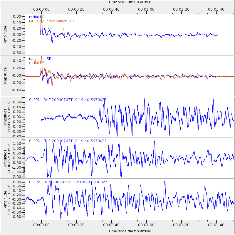
Earthquake location: Baffin Bay
Earthquake latitude/longitude: 75.4/-72.5
Earthquake time(UTC): 2009/07/07 (188) 19:11:46 GMT
Earthquake Depth: 19 km
Earthquake Magnitude: 5.9 MB, 5.7 MS, 6.1 MW, 6.0 MW
Earthquake Catalog/Contributor: WHDF/NEIC
Network: CI Caltech Regional Seismic Network
Station: BFS Mt Baldy Forest Station
Lat/Lon: 34.24 N/117.66 W
Elevation: 1312 m
Distance: 46.4 deg
Az: 234.332 deg
Baz: 14.452 deg
Ray Param: 0.070672
Estimated Moho Depth: 10.0 km
Estimated Crust Vp/Vs: 2.03
Assumed Crust Vp: 6.276 km/s
Estimated Crust Vs: 3.099 km/s
Estimated Crust Poisson's Ratio: 0.34
Radial Match: 92.68261 %
Radial Bump: 399
Transverse Match: 89.53103 %
Transverse Bump: 400
SOD ConfigId: 2648
Insert Time: 2010-03-05 20:54:30.495 +0000
GWidth: 2.5
Max Bumps: 400
Tol: 0.001

Signal To Noise

ChannelStoNSTALTA
CI:BFS: :BHZ:20090707T19:19:40.693002Z9.6094721.1649219E-61.2122642E-7
CI:BFS: :BHN:20090707T19:19:40.693002Z4.053853.454605E-78.521788E-8
CI:BFS: :BHE:20090707T19:19:40.693002Z3.40509251.9844786E-75.8279728E-8
Arrivals
Ps1.7 SECOND
PpPs4.6 SECOND
PsPs/PpSs6.3 SECOND