BFS Mt Baldy Forest Station - Earthquake Result Viewer
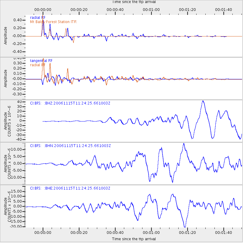
Earthquake location: Kuril Islands
Earthquake latitude/longitude: 46.6/153.3
Earthquake time(UTC): 2006/11/15 (319) 11:14:13 GMT
Earthquake Depth: 10 km
Earthquake Magnitude: 6.5 MB, 7.8 MS, 8.3 MW, 7.9 MW
Earthquake Catalog/Contributor: WHDF/NEIC
Network: CI Caltech Regional Seismic Network
Station: BFS Mt Baldy Forest Station
Lat/Lon: 34.24 N/117.66 W
Elevation: 1312 m
Distance: 65.5 deg
Az: 65.554 deg
Baz: 310.729 deg
Ray Param: 0.058235493
Estimated Moho Depth: 28.0 km
Estimated Crust Vp/Vs: 1.84
Assumed Crust Vp: 6.276 km/s
Estimated Crust Vs: 3.406 km/s
Estimated Crust Poisson's Ratio: 0.29
Radial Match: 98.50314 %
Radial Bump: 367
Transverse Match: 89.83556 %
Transverse Bump: 400
SOD ConfigId: 2564
Insert Time: 2010-03-05 20:54:33.334 +0000
GWidth: 2.5
Max Bumps: 400
Tol: 0.001

Signal To Noise

ChannelStoNSTALTA
CI:BFS: :BHN:20061115T11:24:25.661003Z2.29928546.0060745E-72.6121484E-7
CI:BFS: :BHE:20061115T11:24:25.661003Z3.56944426.8991284E-71.9328299E-7
CI:BFS: :BHZ:20061115T11:24:25.661003Z3.48563481.5816163E-64.5375273E-7
Arrivals
Ps3.9 SECOND
PpPs12 SECOND
PsPs/PpSs16 SECOND