BFS Mt Baldy Forest Station - Earthquake Result Viewer
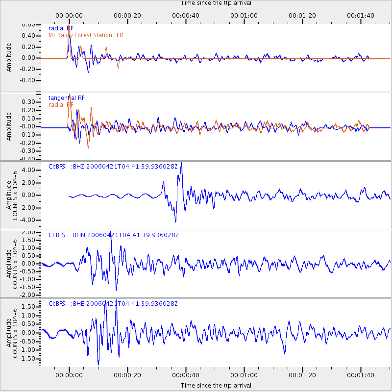
Earthquake location: Eastern Siberia, Russia
Earthquake latitude/longitude: 60.5/165.8
Earthquake time(UTC): 2006/04/21 (111) 04:32:43 GMT
Earthquake Depth: 9.0 km
Earthquake Magnitude: 6.3 MB, 5.6 MS, 6.1 MW, 6.1 ME
Earthquake Catalog/Contributor: WHDF/NEIC
Network: CI Caltech Regional Seismic Network
Station: BFS Mt Baldy Forest Station
Lat/Lon: 34.24 N/117.66 W
Elevation: 1312 m
Distance: 54.4 deg
Az: 82.283 deg
Baz: 323.735 deg
Ray Param: 0.06547952
Estimated Moho Depth: 10.75 km
Estimated Crust Vp/Vs: 2.02
Assumed Crust Vp: 6.276 km/s
Estimated Crust Vs: 3.107 km/s
Estimated Crust Poisson's Ratio: 0.34
Radial Match: 89.792336 %
Radial Bump: 400
Transverse Match: 67.60101 %
Transverse Bump: 400
SOD ConfigId: 2669
Insert Time: 2010-03-05 20:54:54.121 +0000
GWidth: 2.5
Max Bumps: 400
Tol: 0.001

Signal To Noise

ChannelStoNSTALTA
CI:BFS: :BHN:20060421T04:41:39.936028Z1.35405162.3592374E-71.742354E-7
CI:BFS: :BHE:20060421T04:41:39.936028Z0.73616851.4255589E-71.9364575E-7
CI:BFS: :BHZ:20060421T04:41:39.936028Z4.9959949.042979E-71.810046E-7
Arrivals
Ps1.8 SECOND
PpPs4.9 SECOND
PsPs/PpSs6.8 SECOND