You are here: Home > Network List > CI - Caltech Regional Seismic Network Stations List
> Station BFS Mt Baldy Forest Station > Earthquake Result Viewer
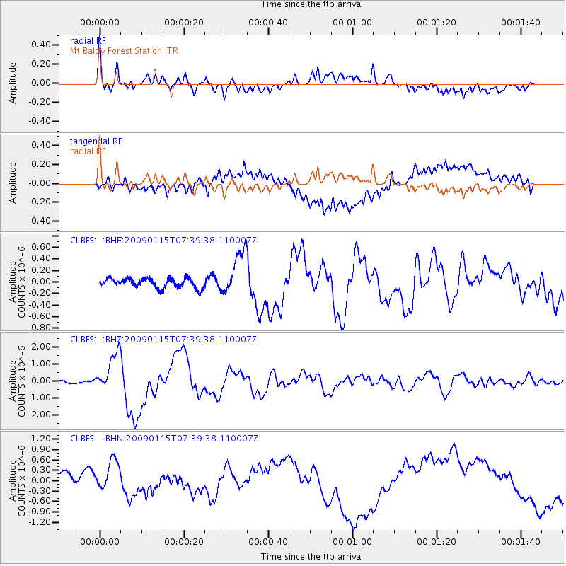
BFS Mt Baldy Forest Station - Earthquake Result Viewer
*The percent match for this event was below the threshold and hence no stack was calculated.
| Earthquake location: |
Southeast Of Loyalty Islands |
| Earthquake latitude/longitude: |
-22.4/170.6 |
| Earthquake time(UTC): |
2009/01/15 (015) 07:27:20 GMT |
| Earthquake Depth: |
27 km |
| Earthquake Magnitude: |
5.8 MB, 6.5 MS, 6.7 MW, 6.6 MW |
| Earthquake Catalog/Contributor: |
WHDF/NEIC |
|
| Network: |
CI Caltech Regional Seismic Network |
| Station: |
BFS Mt Baldy Forest Station |
| Lat/Lon: |
34.24 N/117.66 W |
| Elevation: |
1312 m |
|
| Distance: |
88.3 deg |
| Az: |
51.898 deg |
| Baz: |
241.563 deg |
| Ray Param: |
$rayparam |
*The percent match for this event was below the threshold and hence was not used in the summary stack. |
|
| Radial Match: |
73.67754 % |
| Radial Bump: |
400 |
| Transverse Match: |
56.00574 % |
| Transverse Bump: |
400 |
| SOD ConfigId: |
2834 |
| Insert Time: |
2010-03-05 20:55:36.652 +0000 |
| GWidth: |
2.5 |
| Max Bumps: |
400 |
| Tol: |
0.001 |
|
Signal To Noise
| Channel | StoN | STA | LTA |
| CI:BFS: :BHZ:20090115T07:39:38.110007Z | 10.551293 | 1.1793326E-6 | 1.1177137E-7 |
| CI:BFS: :BHN:20090115T07:39:38.110007Z | 1.3550681 | 6.026135E-7 | 4.4471085E-7 |
| CI:BFS: :BHE:20090115T07:39:38.110007Z | 4.6750255 | 3.915455E-7 | 8.3752596E-8 |
| Arrivals |
| Ps | |
| PpPs | |
| PsPs/PpSs | |


