You are here: Home > Network List > UW - Pacific Northwest Regional Seismic Network Stations List
> Station UMAT Pilot Rock, OR, USA > Earthquake Result Viewer
UMAT Pilot Rock, OR, USA - Earthquake Result Viewer
*The percent match for this event was below the threshold and hence no stack was calculated.
| Earthquake location: |
Southern Chile |
| Earthquake latitude/longitude: |
-43.3/-74.5 |
| Earthquake time(UTC): |
2016/12/25 (360) 14:22:28 GMT |
| Earthquake Depth: |
15 km |
| Earthquake Magnitude: |
7.7 Mi |
| Earthquake Catalog/Contributor: |
NEIC PDE/at |
|
| Network: |
UW Pacific Northwest Regional Seismic Network |
| Station: |
UMAT Pilot Rock, OR, USA |
| Lat/Lon: |
45.29 N/118.96 W |
| Elevation: |
1318 m |
|
| Distance: |
96.7 deg |
| Az: |
330.146 deg |
| Baz: |
149.014 deg |
| Ray Param: |
$rayparam |
*The percent match for this event was below the threshold and hence was not used in the summary stack. |
|
| Radial Match: |
94.672165 % |
| Radial Bump: |
394 |
| Transverse Match: |
75.24694 % |
| Transverse Bump: |
400 |
| SOD ConfigId: |
11737051 |
| Insert Time: |
2019-04-26 10:45:56.306 +0000 |
| GWidth: |
2.5 |
| Max Bumps: |
400 |
| Tol: |
0.001 |
|
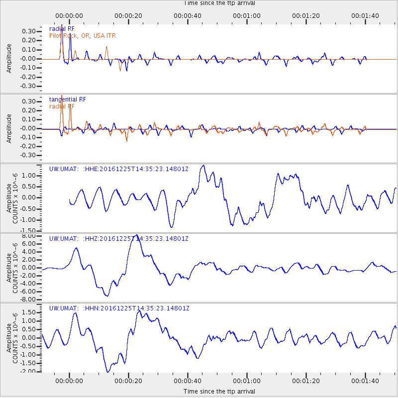
Signal To Noise
| Channel | StoN | STA | LTA |
| UW:UMAT: :HHZ:20161225T14:35:23.14801Z | 16.267435 | 3.0565438E-6 | 1.8789342E-7 |
| UW:UMAT: :HHN:20161225T14:35:23.14801Z | 4.977818 | 9.078941E-7 | 1.8238796E-7 |
| UW:UMAT: :HHE:20161225T14:35:23.14801Z | 2.8392632 | 7.529594E-7 | 2.6519535E-7 |
| Arrivals |
| Ps | |
| PpPs | |
| PsPs/PpSs | |


