You are here: Home > Network List > CI - Caltech Regional Seismic Network Stations List
> Station BFS Mt Baldy Forest Station > Earthquake Result Viewer
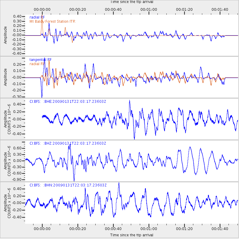
BFS Mt Baldy Forest Station - Earthquake Result Viewer
*The percent match for this event was below the threshold and hence no stack was calculated.
| Earthquake location: |
Near East Coast Of Honshu, Japan |
| Earthquake latitude/longitude: |
36.7/141.1 |
| Earthquake time(UTC): |
2009/01/31 (031) 21:51:52 GMT |
| Earthquake Depth: |
34 km |
| Earthquake Magnitude: |
5.6 MB, 5.3 MS, 5.8 MW, 5.7 MW |
| Earthquake Catalog/Contributor: |
WHDF/NEIC |
|
| Network: |
CI Caltech Regional Seismic Network |
| Station: |
BFS Mt Baldy Forest Station |
| Lat/Lon: |
34.24 N/117.66 W |
| Elevation: |
1312 m |
|
| Distance: |
78.2 deg |
| Az: |
56.118 deg |
| Baz: |
306.373 deg |
| Ray Param: |
$rayparam |
*The percent match for this event was below the threshold and hence was not used in the summary stack. |
|
| Radial Match: |
41.873257 % |
| Radial Bump: |
400 |
| Transverse Match: |
59.99193 % |
| Transverse Bump: |
400 |
| SOD ConfigId: |
2658 |
| Insert Time: |
2010-03-05 20:56:45.194 +0000 |
| GWidth: |
2.5 |
| Max Bumps: |
400 |
| Tol: |
0.001 |
|
Signal To Noise
| Channel | StoN | STA | LTA |
| CI:BFS: :BHZ:20090131T22:03:17.23603Z | 2.0626366 | 2.6560483E-7 | 1.2876957E-7 |
| CI:BFS: :BHN:20090131T22:03:17.23603Z | 0.9176653 | 6.99327E-8 | 7.62072E-8 |
| CI:BFS: :BHE:20090131T22:03:17.23603Z | 1.1811699 | 8.592014E-8 | 7.274156E-8 |
| Arrivals |
| Ps | |
| PpPs | |
| PsPs/PpSs | |


