You are here: Home > Network List > UU - University of Utah Regional Network Stations List
> Station CCUT Cedar City, UT, USA > Earthquake Result Viewer
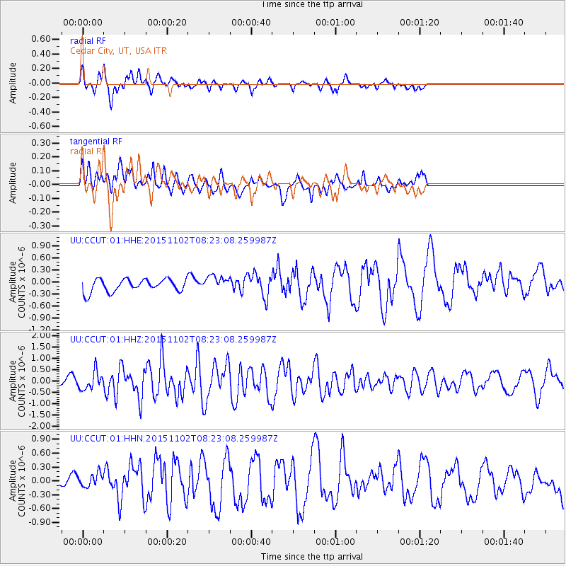
CCUT Cedar City, UT, USA - Earthquake Result Viewer
*The percent match for this event was below the threshold and hence no stack was calculated.
| Earthquake location: |
Andreanof Islands, Aleutian Is. |
| Earthquake latitude/longitude: |
51.7/-173.4 |
| Earthquake time(UTC): |
2015/11/02 (306) 08:15:34 GMT |
| Earthquake Depth: |
21 km |
| Earthquake Magnitude: |
5.9 MWP, 5.2 MI |
| Earthquake Catalog/Contributor: |
NEIC PDE/NEIC COMCAT |
|
| Network: |
UU University of Utah Regional Network |
| Station: |
CCUT Cedar City, UT, USA |
| Lat/Lon: |
37.55 N/113.36 W |
| Elevation: |
2127 m |
|
| Distance: |
43.8 deg |
| Az: |
84.382 deg |
| Baz: |
308.734 deg |
| Ray Param: |
$rayparam |
*The percent match for this event was below the threshold and hence was not used in the summary stack. |
|
| Radial Match: |
52.56608 % |
| Radial Bump: |
380 |
| Transverse Match: |
44.003456 % |
| Transverse Bump: |
400 |
| SOD ConfigId: |
1259291 |
| Insert Time: |
2015-11-16 08:30:49.930 +0000 |
| GWidth: |
2.5 |
| Max Bumps: |
400 |
| Tol: |
0.001 |
|
Signal To Noise
| Channel | StoN | STA | LTA |
| UU:CCUT:01:HHZ:20151102T08:23:08.259987Z | 2.1810238 | 3.9714223E-7 | 1.820898E-7 |
| UU:CCUT:01:HHN:20151102T08:23:08.259987Z | 0.95711505 | 1.7181608E-7 | 1.7951454E-7 |
| UU:CCUT:01:HHE:20151102T08:23:08.259987Z | 1.2128143 | 1.9042763E-7 | 1.57013E-7 |
| Arrivals |
| Ps | |
| PpPs | |
| PsPs/PpSs | |


