You are here: Home > Network List > TA - USArray Transportable Network (new EarthScope stations) Stations List
> Station G21K Allakaket, AK, USA > Earthquake Result Viewer
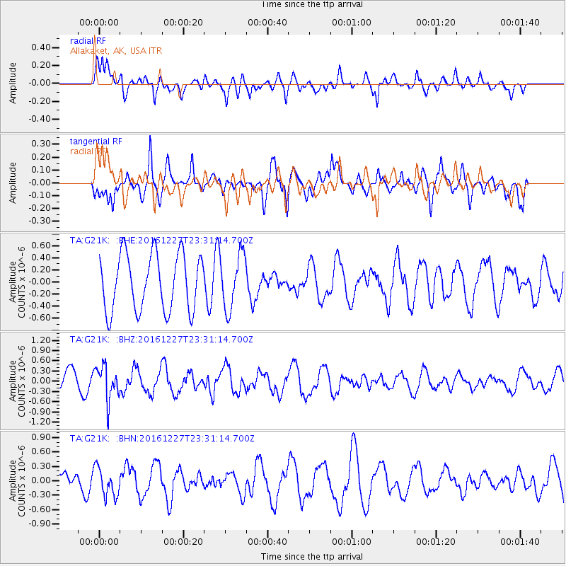
G21K Allakaket, AK, USA - Earthquake Result Viewer
*The percent match for this event was below the threshold and hence no stack was calculated.
| Earthquake location: |
Romania |
| Earthquake latitude/longitude: |
45.7/26.6 |
| Earthquake time(UTC): |
2016/12/27 (362) 23:20:55 GMT |
| Earthquake Depth: |
81 km |
| Earthquake Magnitude: |
5.6 mb |
| Earthquake Catalog/Contributor: |
NEIC PDE/us |
|
| Network: |
TA USArray Transportable Network (new EarthScope stations) |
| Station: |
G21K Allakaket, AK, USA |
| Lat/Lon: |
66.52 N/153.51 W |
| Elevation: |
446 m |
|
| Distance: |
68.1 deg |
| Az: |
0.049 deg |
| Baz: |
359.914 deg |
| Ray Param: |
$rayparam |
*The percent match for this event was below the threshold and hence was not used in the summary stack. |
|
| Radial Match: |
66.56942 % |
| Radial Bump: |
400 |
| Transverse Match: |
40.302837 % |
| Transverse Bump: |
387 |
| SOD ConfigId: |
11737051 |
| Insert Time: |
2019-04-26 11:03:08.062 +0000 |
| GWidth: |
2.5 |
| Max Bumps: |
400 |
| Tol: |
0.001 |
|
Signal To Noise
| Channel | StoN | STA | LTA |
| TA:G21K: :BHZ:20161227T23:31:14.700Z | 1.8888836 | 5.0423614E-7 | 2.6694929E-7 |
| TA:G21K: :BHN:20161227T23:31:14.700Z | 1.2395338 | 2.8723895E-7 | 2.3173143E-7 |
| TA:G21K: :BHE:20161227T23:31:14.700Z | 0.95753646 | 4.4555944E-7 | 4.6531852E-7 |
| Arrivals |
| Ps | |
| PpPs | |
| PsPs/PpSs | |


