You are here: Home > Network List > TA - USArray Transportable Network (new EarthScope stations) Stations List
> Station R17K Ugashik Creek, AK, USA > Earthquake Result Viewer
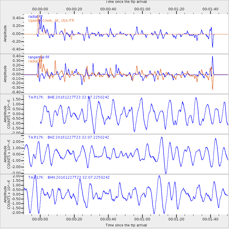
R17K Ugashik Creek, AK, USA - Earthquake Result Viewer
*The percent match for this event was below the threshold and hence no stack was calculated.
| Earthquake location: |
Romania |
| Earthquake latitude/longitude: |
45.7/26.6 |
| Earthquake time(UTC): |
2016/12/27 (362) 23:20:55 GMT |
| Earthquake Depth: |
81 km |
| Earthquake Magnitude: |
5.6 mb |
| Earthquake Catalog/Contributor: |
NEIC PDE/us |
|
| Network: |
TA USArray Transportable Network (new EarthScope stations) |
| Station: |
R17K Ugashik Creek, AK, USA |
| Lat/Lon: |
57.64 N/156.39 W |
| Elevation: |
273 m |
|
| Distance: |
77.0 deg |
| Az: |
1.653 deg |
| Baz: |
357.847 deg |
| Ray Param: |
$rayparam |
*The percent match for this event was below the threshold and hence was not used in the summary stack. |
|
| Radial Match: |
62.70739 % |
| Radial Bump: |
400 |
| Transverse Match: |
52.93628 % |
| Transverse Bump: |
400 |
| SOD ConfigId: |
11737051 |
| Insert Time: |
2019-04-26 11:03:33.092 +0000 |
| GWidth: |
2.5 |
| Max Bumps: |
400 |
| Tol: |
0.001 |
|
Signal To Noise
| Channel | StoN | STA | LTA |
| TA:R17K: :BHZ:20161227T23:32:07.225024Z | 1.1096971 | 1.204908E-6 | 1.085799E-6 |
| TA:R17K: :BHN:20161227T23:32:07.225024Z | 1.1072308 | 7.762786E-7 | 7.010992E-7 |
| TA:R17K: :BHE:20161227T23:32:07.225024Z | 1.9818858 | 1.0957813E-6 | 5.5289826E-7 |
| Arrivals |
| Ps | |
| PpPs | |
| PsPs/PpSs | |


