You are here: Home > Network List > II - Global Seismograph Network (GSN - IRIS/IDA) Stations List
> Station WRAB Tennant Creek, NT, Australia > Earthquake Result Viewer
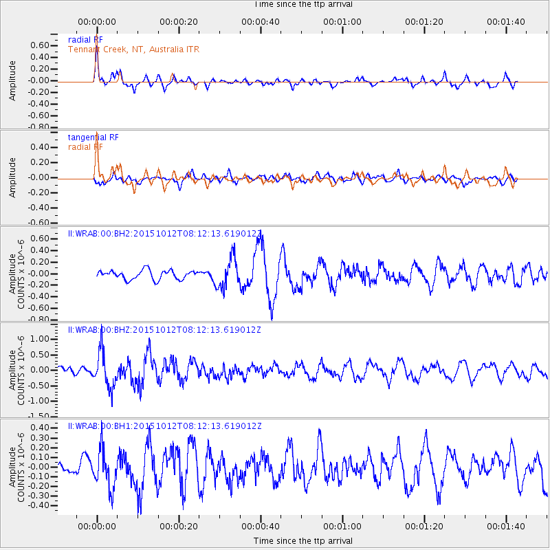
WRAB Tennant Creek, NT, Australia - Earthquake Result Viewer
*The percent match for this event was below the threshold and hence no stack was calculated.
| Earthquake location: |
North Island, New Zealand |
| Earthquake latitude/longitude: |
-40.6/176.3 |
| Earthquake time(UTC): |
2015/10/12 (285) 08:05:01 GMT |
| Earthquake Depth: |
22 km |
| Earthquake Magnitude: |
5.6 MWW, 5.5 MWB, 5.6 MWC |
| Earthquake Catalog/Contributor: |
NEIC PDE/NEIC COMCAT |
|
| Network: |
II Global Seismograph Network (GSN - IRIS/IDA) |
| Station: |
WRAB Tennant Creek, NT, Australia |
| Lat/Lon: |
19.93 S/134.36 E |
| Elevation: |
366 m |
|
| Distance: |
41.2 deg |
| Az: |
287.273 deg |
| Baz: |
129.375 deg |
| Ray Param: |
$rayparam |
*The percent match for this event was below the threshold and hence was not used in the summary stack. |
|
| Radial Match: |
70.04687 % |
| Radial Bump: |
369 |
| Transverse Match: |
49.58833 % |
| Transverse Bump: |
400 |
| SOD ConfigId: |
1259291 |
| Insert Time: |
2015-11-17 16:05:37.864 +0000 |
| GWidth: |
2.5 |
| Max Bumps: |
400 |
| Tol: |
0.001 |
|
Signal To Noise
| Channel | StoN | STA | LTA |
| II:WRAB:00:BHZ:20151012T08:12:13.619012Z | 4.326912 | 5.92364E-7 | 1.3690226E-7 |
| II:WRAB:00:BH1:20151012T08:12:13.619012Z | 2.1909187 | 1.9975325E-7 | 9.117328E-8 |
| II:WRAB:00:BH2:20151012T08:12:13.619012Z | 3.3496099 | 2.6042665E-7 | 7.7748346E-8 |
| Arrivals |
| Ps | |
| PpPs | |
| PsPs/PpSs | |


