You are here: Home > Network List > IU - Global Seismograph Network (GSN - IRIS/USGS) Stations List
> Station PMG Port Moresby, New Guinea > Earthquake Result Viewer
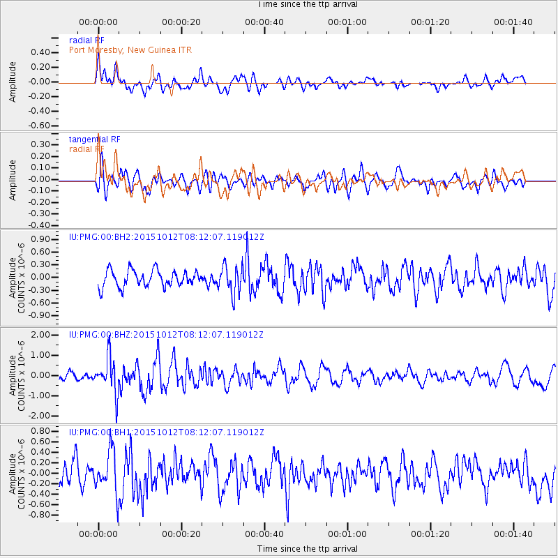
PMG Port Moresby, New Guinea - Earthquake Result Viewer
*The percent match for this event was below the threshold and hence no stack was calculated.
| Earthquake location: |
North Island, New Zealand |
| Earthquake latitude/longitude: |
-40.6/176.3 |
| Earthquake time(UTC): |
2015/10/12 (285) 08:05:01 GMT |
| Earthquake Depth: |
22 km |
| Earthquake Magnitude: |
5.6 MWW, 5.5 MWB, 5.6 MWC |
| Earthquake Catalog/Contributor: |
NEIC PDE/NEIC COMCAT |
|
| Network: |
IU Global Seismograph Network (GSN - IRIS/USGS) |
| Station: |
PMG Port Moresby, New Guinea |
| Lat/Lon: |
9.40 S/147.16 E |
| Elevation: |
90 m |
|
| Distance: |
40.4 deg |
| Az: |
312.161 deg |
| Baz: |
145.1 deg |
| Ray Param: |
$rayparam |
*The percent match for this event was below the threshold and hence was not used in the summary stack. |
|
| Radial Match: |
63.21591 % |
| Radial Bump: |
400 |
| Transverse Match: |
50.609573 % |
| Transverse Bump: |
400 |
| SOD ConfigId: |
1259291 |
| Insert Time: |
2015-11-17 16:06:15.308 +0000 |
| GWidth: |
2.5 |
| Max Bumps: |
400 |
| Tol: |
0.001 |
|
Signal To Noise
| Channel | StoN | STA | LTA |
| IU:PMG:00:BHZ:20151012T08:12:07.119012Z | 5.386836 | 8.9679037E-7 | 1.6647813E-7 |
| IU:PMG:00:BH1:20151012T08:12:07.119012Z | 2.1308672 | 4.10057E-7 | 1.9243666E-7 |
| IU:PMG:00:BH2:20151012T08:12:07.119012Z | 1.7725052 | 3.41172E-7 | 1.9248013E-7 |
| Arrivals |
| Ps | |
| PpPs | |
| PsPs/PpSs | |


