You are here: Home > Network List > TA - USArray Transportable Network (new EarthScope stations) Stations List
> Station 121A Cookes Peak, Deming, NM, USA > Earthquake Result Viewer
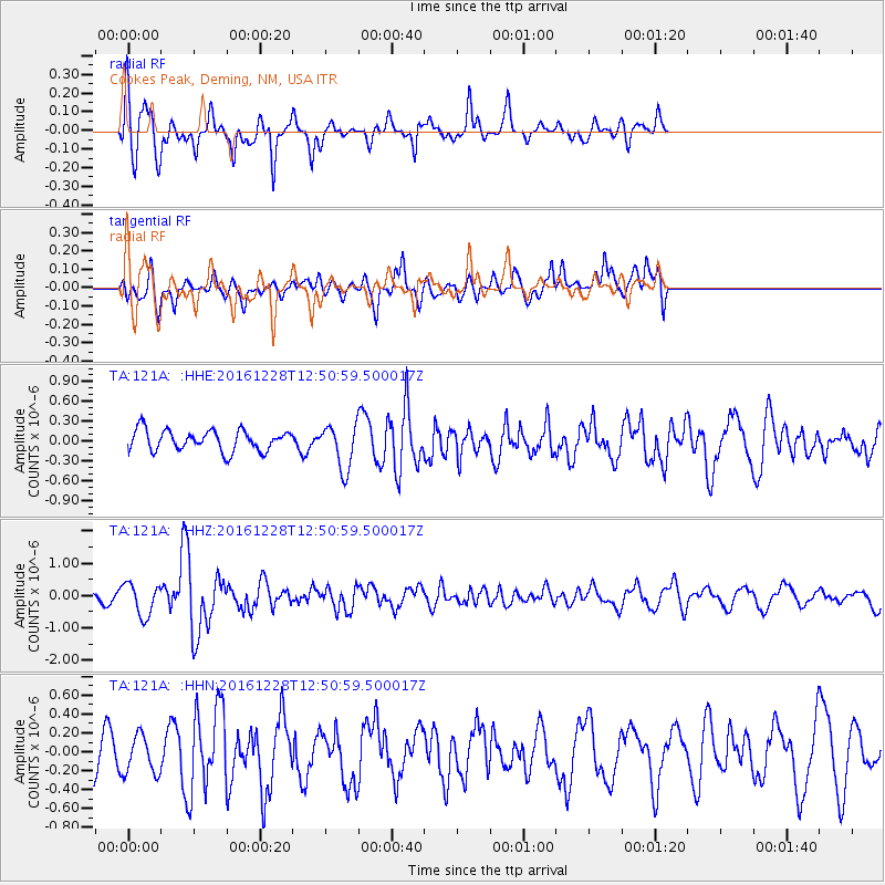
121A Cookes Peak, Deming, NM, USA - Earthquake Result Viewer
*The percent match for this event was below the threshold and hence no stack was calculated.
| Earthquake location: |
Near East Coast Of Honshu, Japan |
| Earthquake latitude/longitude: |
36.9/140.4 |
| Earthquake time(UTC): |
2016/12/28 (363) 12:38:50 GMT |
| Earthquake Depth: |
10 km |
| Earthquake Magnitude: |
5.9 Mww |
| Earthquake Catalog/Contributor: |
NEIC PDE/us |
|
| Network: |
TA USArray Transportable Network (new EarthScope stations) |
| Station: |
121A Cookes Peak, Deming, NM, USA |
| Lat/Lon: |
32.53 N/107.79 W |
| Elevation: |
1652 m |
|
| Distance: |
86.1 deg |
| Az: |
51.835 deg |
| Baz: |
311.76 deg |
| Ray Param: |
$rayparam |
*The percent match for this event was below the threshold and hence was not used in the summary stack. |
|
| Radial Match: |
75.10775 % |
| Radial Bump: |
383 |
| Transverse Match: |
65.11138 % |
| Transverse Bump: |
400 |
| SOD ConfigId: |
11737051 |
| Insert Time: |
2019-04-26 11:27:57.035 +0000 |
| GWidth: |
2.5 |
| Max Bumps: |
400 |
| Tol: |
0.001 |
|
Signal To Noise
| Channel | StoN | STA | LTA |
| TA:121A: :HHZ:20161228T12:50:59.500017Z | 2.0310411 | 4.980255E-7 | 2.45207E-7 |
| TA:121A: :HHN:20161228T12:50:59.500017Z | 0.7039017 | 2.0136545E-7 | 2.8607042E-7 |
| TA:121A: :HHE:20161228T12:50:59.500017Z | 2.4358559 | 3.7621032E-7 | 1.5444688E-7 |
| Arrivals |
| Ps | |
| PpPs | |
| PsPs/PpSs | |


