You are here: Home > Network List > TA - USArray Transportable Network (new EarthScope stations) Stations List
> Station G21K Allakaket, AK, USA > Earthquake Result Viewer
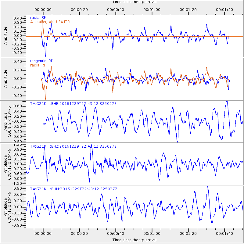
G21K Allakaket, AK, USA - Earthquake Result Viewer
*The percent match for this event was below the threshold and hence no stack was calculated.
| Earthquake location: |
Sumbawa Region, Indonesia |
| Earthquake latitude/longitude: |
-9.1/118.6 |
| Earthquake time(UTC): |
2016/12/29 (364) 22:30:18 GMT |
| Earthquake Depth: |
72 km |
| Earthquake Magnitude: |
6.2 Mwp |
| Earthquake Catalog/Contributor: |
NEIC PDE/us |
|
| Network: |
TA USArray Transportable Network (new EarthScope stations) |
| Station: |
G21K Allakaket, AK, USA |
| Lat/Lon: |
66.52 N/153.51 W |
| Elevation: |
446 m |
|
| Distance: |
97.4 deg |
| Az: |
23.819 deg |
| Baz: |
264.437 deg |
| Ray Param: |
$rayparam |
*The percent match for this event was below the threshold and hence was not used in the summary stack. |
|
| Radial Match: |
71.253395 % |
| Radial Bump: |
378 |
| Transverse Match: |
62.09658 % |
| Transverse Bump: |
400 |
| SOD ConfigId: |
11737051 |
| Insert Time: |
2019-04-26 11:34:08.908 +0000 |
| GWidth: |
2.5 |
| Max Bumps: |
400 |
| Tol: |
0.001 |
|
Signal To Noise
| Channel | StoN | STA | LTA |
| TA:G21K: :BHZ:20161229T22:43:12.325027Z | 1.8199418 | 5.079601E-7 | 2.791079E-7 |
| TA:G21K: :BHN:20161229T22:43:12.325027Z | 0.5947227 | 1.417807E-7 | 2.3839802E-7 |
| TA:G21K: :BHE:20161229T22:43:12.325027Z | 0.95524657 | 2.595839E-7 | 2.7174548E-7 |
| Arrivals |
| Ps | |
| PpPs | |
| PsPs/PpSs | |


