You are here: Home > Network List > TA - USArray Transportable Network (new EarthScope stations) Stations List
> Station R11A Troy Canyon, Currant, NV, USA > Earthquake Result Viewer
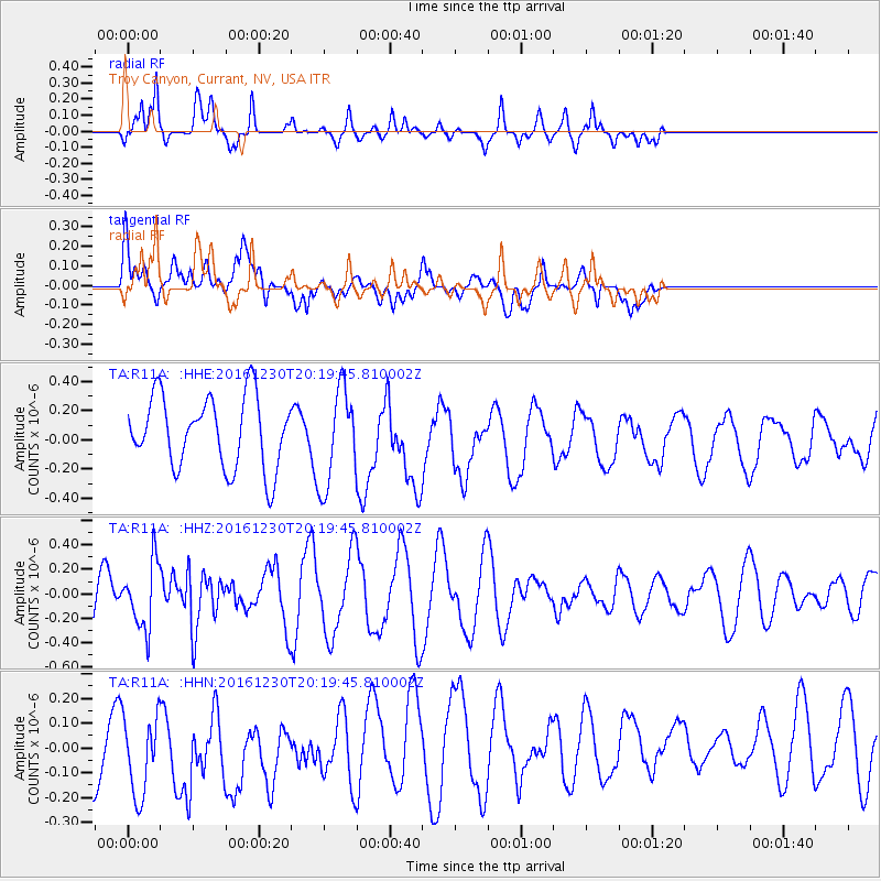
R11A Troy Canyon, Currant, NV, USA - Earthquake Result Viewer
*The percent match for this event was below the threshold and hence no stack was calculated.
| Earthquake location: |
Near East Coast Of Honshu, Japan |
| Earthquake latitude/longitude: |
37.4/141.4 |
| Earthquake time(UTC): |
2016/12/30 (365) 20:08:27 GMT |
| Earthquake Depth: |
12 km |
| Earthquake Magnitude: |
5.5 mb |
| Earthquake Catalog/Contributor: |
NEIC PDE/us |
|
| Network: |
TA USArray Transportable Network (new EarthScope stations) |
| Station: |
R11A Troy Canyon, Currant, NV, USA |
| Lat/Lon: |
38.35 N/115.59 W |
| Elevation: |
1756 m |
|
| Distance: |
76.5 deg |
| Az: |
51.975 deg |
| Baz: |
307.07 deg |
| Ray Param: |
$rayparam |
*The percent match for this event was below the threshold and hence was not used in the summary stack. |
|
| Radial Match: |
79.37697 % |
| Radial Bump: |
355 |
| Transverse Match: |
40.643654 % |
| Transverse Bump: |
400 |
| SOD ConfigId: |
11737051 |
| Insert Time: |
2019-04-26 11:43:05.449 +0000 |
| GWidth: |
2.5 |
| Max Bumps: |
400 |
| Tol: |
0.001 |
|
Signal To Noise
| Channel | StoN | STA | LTA |
| TA:R11A: :HHZ:20161230T20:19:45.810002Z | 1.46254 | 2.7225298E-7 | 1.8615079E-7 |
| TA:R11A: :HHN:20161230T20:19:45.810002Z | 1.0772046 | 2.0939991E-7 | 1.9439197E-7 |
| TA:R11A: :HHE:20161230T20:19:45.810002Z | 1.3541584 | 3.300322E-7 | 2.4371758E-7 |
| Arrivals |
| Ps | |
| PpPs | |
| PsPs/PpSs | |


