You are here: Home > Network List > CI - Caltech Regional Seismic Network Stations List
> Station TUQ Turquiose Mountain, Baker, CA, USA > Earthquake Result Viewer
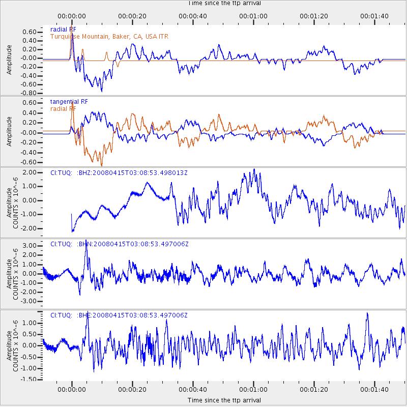
TUQ Turquiose Mountain, Baker, CA, USA - Earthquake Result Viewer
*The percent match for this event was below the threshold and hence no stack was calculated.
| Earthquake location: |
Near Coast Of Guatemala |
| Earthquake latitude/longitude: |
13.6/-90.6 |
| Earthquake time(UTC): |
2008/04/15 (106) 03:03:04 GMT |
| Earthquake Depth: |
33 km |
| Earthquake Magnitude: |
5.6 MB, 5.8 MS, 6.1 MW, 6.1 MW |
| Earthquake Catalog/Contributor: |
WHDF/NEIC |
|
| Network: |
CI Caltech Regional Seismic Network |
| Station: |
TUQ Turquiose Mountain, Baker, CA, USA |
| Lat/Lon: |
35.44 N/115.92 W |
| Elevation: |
1350 m |
|
| Distance: |
31.5 deg |
| Az: |
318.1 deg |
| Baz: |
127.315 deg |
| Ray Param: |
$rayparam |
*The percent match for this event was below the threshold and hence was not used in the summary stack. |
|
| Radial Match: |
49.22242 % |
| Radial Bump: |
400 |
| Transverse Match: |
44.635178 % |
| Transverse Bump: |
400 |
| SOD ConfigId: |
2504 |
| Insert Time: |
2010-03-05 21:02:20.377 +0000 |
| GWidth: |
2.5 |
| Max Bumps: |
400 |
| Tol: |
0.001 |
|
Signal To Noise
| Channel | StoN | STA | LTA |
| CI:TUQ: :BHN:20080415T03:08:53.497006Z | 3.258922 | 1.2151165E-6 | 3.728584E-7 |
| CI:TUQ: :BHE:20080415T03:08:53.497006Z | 2.1328971 | 2.9590987E-7 | 1.3873611E-7 |
| CI:TUQ: :BHZ:20080415T03:08:53.498013Z | 1.1833023 | 8.9674836E-7 | 7.5783544E-7 |
| Arrivals |
| Ps | |
| PpPs | |
| PsPs/PpSs | |


