You are here: Home > Network List > TJ - Tajikistan National Seismic Network Stations List
> Station GARM Garm, Tajikistan > Earthquake Result Viewer
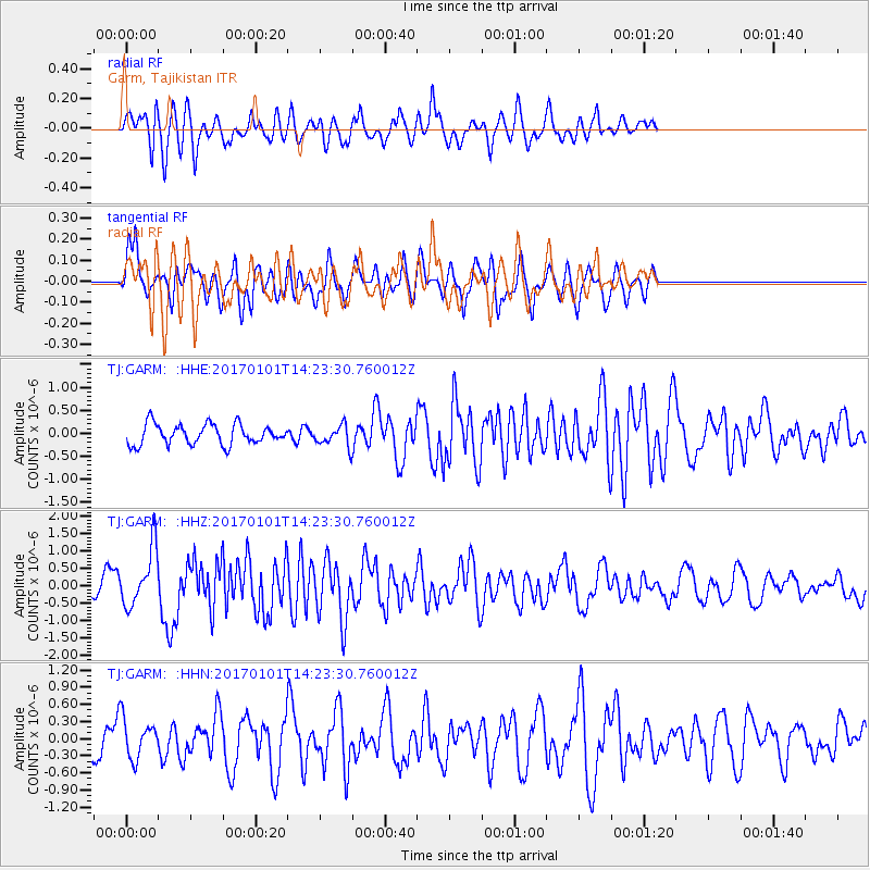
GARM Garm, Tajikistan - Earthquake Result Viewer
*The percent match for this event was below the threshold and hence no stack was calculated.
| Earthquake location: |
North Of Halmahera, Indonesia |
| Earthquake latitude/longitude: |
3.6/128.2 |
| Earthquake time(UTC): |
2017/01/01 (001) 14:13:37 GMT |
| Earthquake Depth: |
35 km |
| Earthquake Magnitude: |
5.5 mb |
| Earthquake Catalog/Contributor: |
NEIC PDE/us |
|
| Network: |
TJ Tajikistan National Seismic Network |
| Station: |
GARM Garm, Tajikistan |
| Lat/Lon: |
39.00 N/70.32 E |
| Elevation: |
1305 m |
|
| Distance: |
63.1 deg |
| Az: |
312.264 deg |
| Baz: |
108.572 deg |
| Ray Param: |
$rayparam |
*The percent match for this event was below the threshold and hence was not used in the summary stack. |
|
| Radial Match: |
75.384285 % |
| Radial Bump: |
400 |
| Transverse Match: |
66.41457 % |
| Transverse Bump: |
400 |
| SOD ConfigId: |
11737051 |
| Insert Time: |
2019-04-26 11:52:30.908 +0000 |
| GWidth: |
2.5 |
| Max Bumps: |
400 |
| Tol: |
0.001 |
|
Signal To Noise
| Channel | StoN | STA | LTA |
| TJ:GARM: :HHZ:20170101T14:23:30.760012Z | 2.5493138 | 8.282979E-7 | 3.2491016E-7 |
| TJ:GARM: :HHN:20170101T14:23:30.760012Z | 1.2160329 | 3.3415262E-7 | 2.7478913E-7 |
| TJ:GARM: :HHE:20170101T14:23:30.760012Z | 1.1413773 | 2.5215513E-7 | 2.209218E-7 |
| Arrivals |
| Ps | |
| PpPs | |
| PsPs/PpSs | |


