You are here: Home > Network List > CI - Caltech Regional Seismic Network Stations List
> Station TUQ Turquiose Mountain, Baker, CA, USA > Earthquake Result Viewer
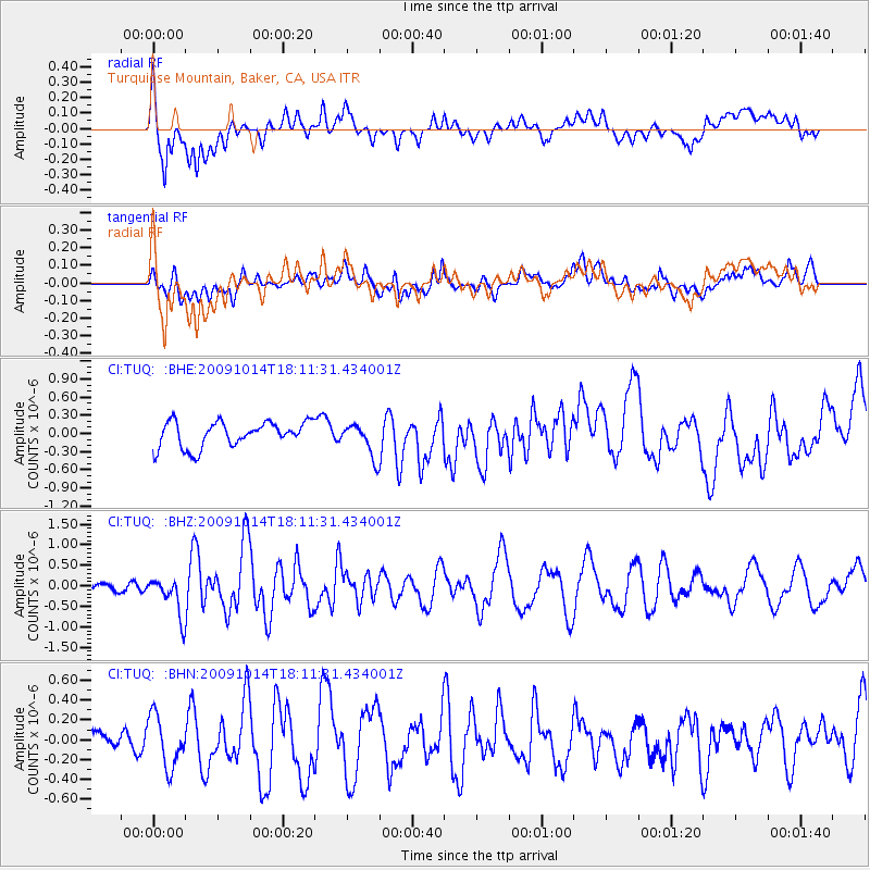
TUQ Turquiose Mountain, Baker, CA, USA - Earthquake Result Viewer
*The percent match for this event was below the threshold and hence no stack was calculated.
| Earthquake location: |
Samoa Islands Region |
| Earthquake latitude/longitude: |
-14.9/-174.8 |
| Earthquake time(UTC): |
2009/10/14 (287) 18:00:21 GMT |
| Earthquake Depth: |
10 km |
| Earthquake Magnitude: |
5.7 MB, 6.0 MS, 6.3 MW, 6.2 MW |
| Earthquake Catalog/Contributor: |
WHDF/NEIC |
|
| Network: |
CI Caltech Regional Seismic Network |
| Station: |
TUQ Turquiose Mountain, Baker, CA, USA |
| Lat/Lon: |
35.44 N/115.92 W |
| Elevation: |
1350 m |
|
| Distance: |
74.9 deg |
| Az: |
46.399 deg |
| Baz: |
239.018 deg |
| Ray Param: |
$rayparam |
*The percent match for this event was below the threshold and hence was not used in the summary stack. |
|
| Radial Match: |
64.89258 % |
| Radial Bump: |
400 |
| Transverse Match: |
44.069057 % |
| Transverse Bump: |
400 |
| SOD ConfigId: |
2622 |
| Insert Time: |
2010-03-05 21:03:34.072 +0000 |
| GWidth: |
2.5 |
| Max Bumps: |
400 |
| Tol: |
0.001 |
|
Signal To Noise
| Channel | StoN | STA | LTA |
| CI:TUQ: :BHZ:20091014T18:11:31.434001Z | 3.338887 | 4.6343547E-7 | 1.387994E-7 |
| CI:TUQ: :BHN:20091014T18:11:31.434001Z | 1.5052333 | 2.5908201E-7 | 1.7212082E-7 |
| CI:TUQ: :BHE:20091014T18:11:31.434001Z | 1.321164 | 2.7701427E-7 | 2.0967438E-7 |
| Arrivals |
| Ps | |
| PpPs | |
| PsPs/PpSs | |


