You are here: Home > Network List > CI - Caltech Regional Seismic Network Stations List
> Station TUQ Turquiose Mountain, Baker, CA, USA > Earthquake Result Viewer
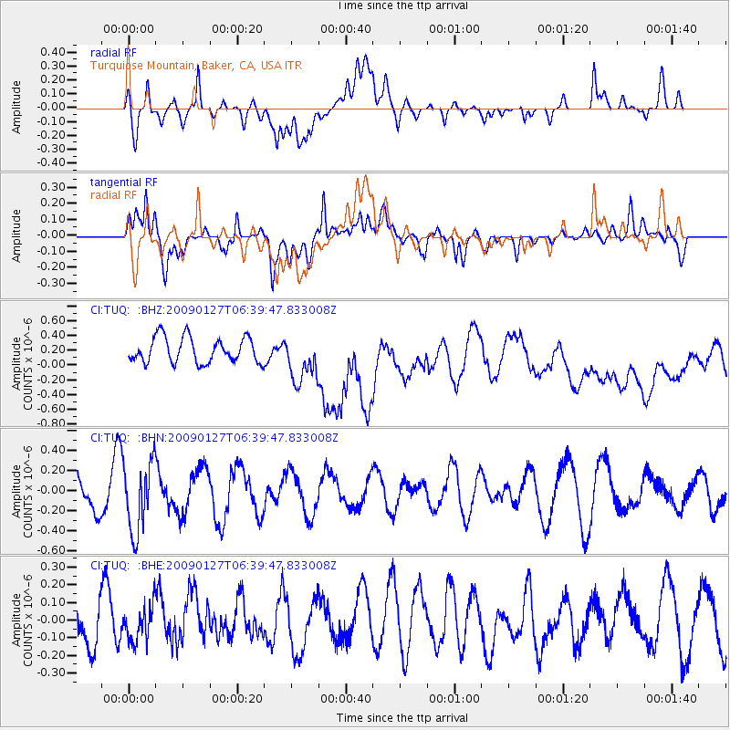
TUQ Turquiose Mountain, Baker, CA, USA - Earthquake Result Viewer
*The percent match for this event was below the threshold and hence no stack was calculated.
| Earthquake location: |
Fiji Islands Region |
| Earthquake latitude/longitude: |
-17.8/-178.7 |
| Earthquake time(UTC): |
2009/01/27 (027) 06:29:13 GMT |
| Earthquake Depth: |
601 km |
| Earthquake Magnitude: |
5.9 MW, 5.1 MB, 5.8 MW |
| Earthquake Catalog/Contributor: |
WHDF/NEIC |
|
| Network: |
CI Caltech Regional Seismic Network |
| Station: |
TUQ Turquiose Mountain, Baker, CA, USA |
| Lat/Lon: |
35.44 N/115.92 W |
| Elevation: |
1350 m |
|
| Distance: |
79.6 deg |
| Az: |
47.57 deg |
| Baz: |
239.425 deg |
| Ray Param: |
$rayparam |
*The percent match for this event was below the threshold and hence was not used in the summary stack. |
|
| Radial Match: |
29.649572 % |
| Radial Bump: |
400 |
| Transverse Match: |
39.909317 % |
| Transverse Bump: |
400 |
| SOD ConfigId: |
2658 |
| Insert Time: |
2010-03-05 21:05:09.656 +0000 |
| GWidth: |
2.5 |
| Max Bumps: |
400 |
| Tol: |
0.001 |
|
Signal To Noise
| Channel | StoN | STA | LTA |
| CI:TUQ: :BHN:20090127T06:39:47.833008Z | 2.087314 | 3.4710322E-7 | 1.6629183E-7 |
| CI:TUQ: :BHE:20090127T06:39:47.833008Z | 0.5138272 | 1.02039515E-7 | 1.9858722E-7 |
| CI:TUQ: :BHZ:20090127T06:39:47.833008Z | 1.9005353 | 3.2679677E-7 | 1.7194985E-7 |
| Arrivals |
| Ps | |
| PpPs | |
| PsPs/PpSs | |


