You are here: Home > Network List > TA - USArray Transportable Network (new EarthScope stations) Stations List
> Station F26K Sheenjek River, AK, USA > Earthquake Result Viewer
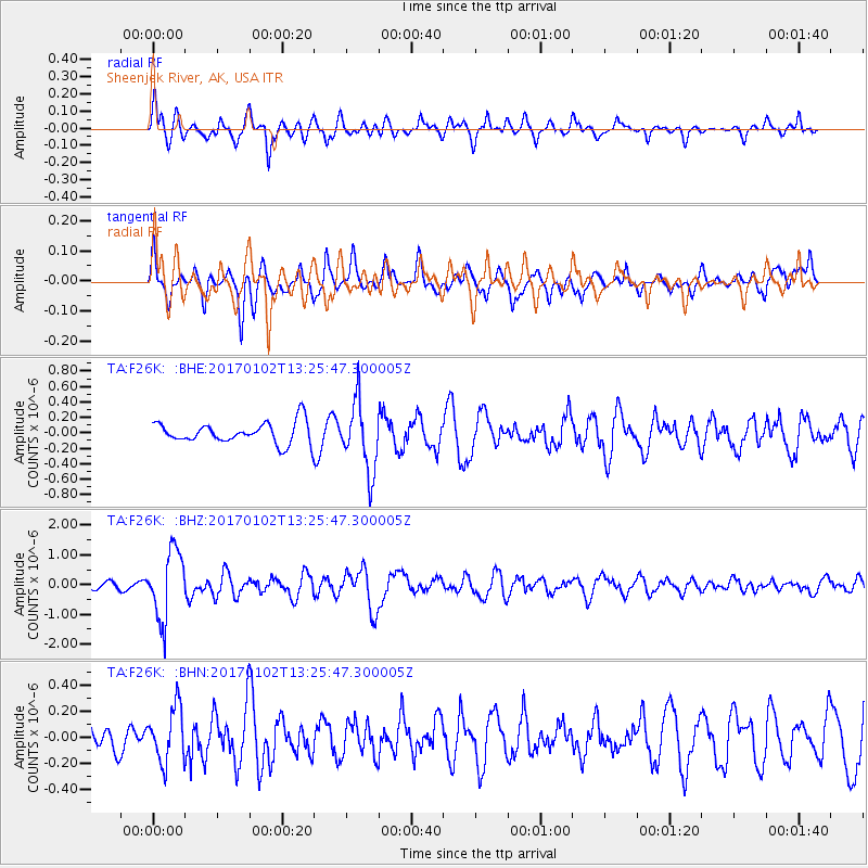
F26K Sheenjek River, AK, USA - Earthquake Result Viewer
*The percent match for this event was below the threshold and hence no stack was calculated.
| Earthquake location: |
Northern Peru |
| Earthquake latitude/longitude: |
-4.9/-76.3 |
| Earthquake time(UTC): |
2017/01/02 (002) 13:13:48 GMT |
| Earthquake Depth: |
108 km |
| Earthquake Magnitude: |
5.9 Mwb |
| Earthquake Catalog/Contributor: |
NEIC PDE/us |
|
| Network: |
TA USArray Transportable Network (new EarthScope stations) |
| Station: |
F26K Sheenjek River, AK, USA |
| Lat/Lon: |
67.69 N/144.15 W |
| Elevation: |
683 m |
|
| Distance: |
86.2 deg |
| Az: |
339.255 deg |
| Baz: |
112.398 deg |
| Ray Param: |
$rayparam |
*The percent match for this event was below the threshold and hence was not used in the summary stack. |
|
| Radial Match: |
68.1309 % |
| Radial Bump: |
400 |
| Transverse Match: |
56.995285 % |
| Transverse Bump: |
400 |
| SOD ConfigId: |
11737051 |
| Insert Time: |
2019-04-26 12:08:22.933 +0000 |
| GWidth: |
2.5 |
| Max Bumps: |
400 |
| Tol: |
0.001 |
|
Signal To Noise
| Channel | StoN | STA | LTA |
| TA:F26K: :BHZ:20170102T13:25:47.300005Z | 7.6128073 | 1.1303226E-6 | 1.4847646E-7 |
| TA:F26K: :BHN:20170102T13:25:47.300005Z | 1.4386961 | 2.0449086E-7 | 1.4213624E-7 |
| TA:F26K: :BHE:20170102T13:25:47.300005Z | 3.2424338 | 4.4063884E-7 | 1.3589755E-7 |
| Arrivals |
| Ps | |
| PpPs | |
| PsPs/PpSs | |


