You are here: Home > Network List > TA - USArray Transportable Network (new EarthScope stations) Stations List
> Station G21K Allakaket, AK, USA > Earthquake Result Viewer
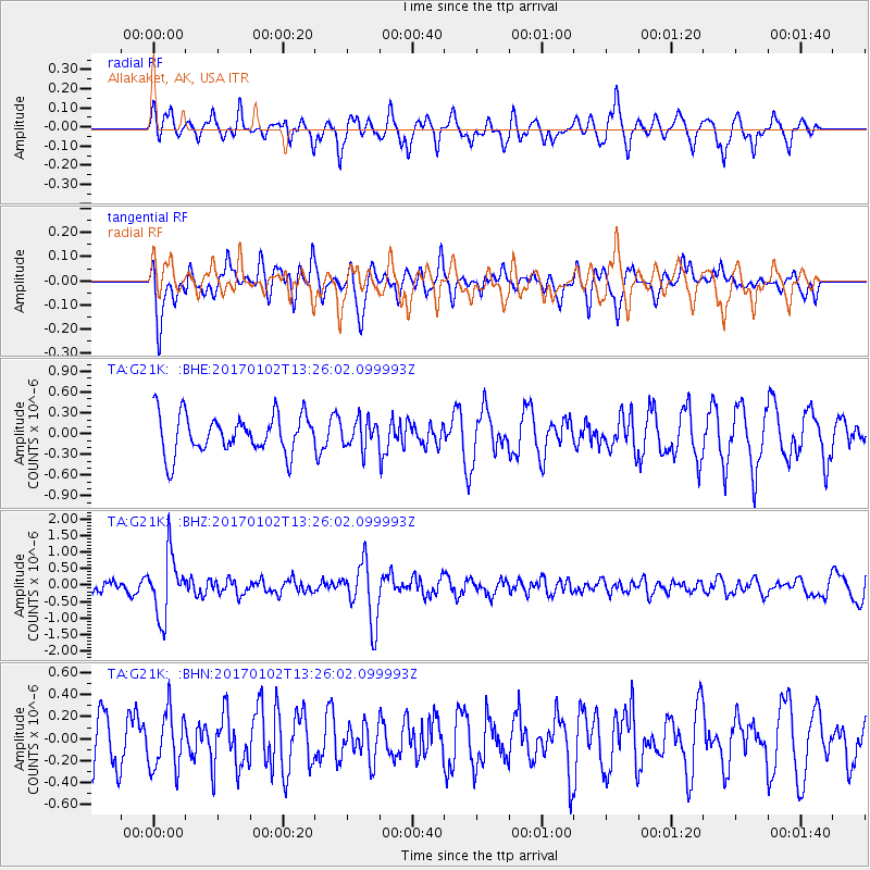
G21K Allakaket, AK, USA - Earthquake Result Viewer
*The percent match for this event was below the threshold and hence no stack was calculated.
| Earthquake location: |
Northern Peru |
| Earthquake latitude/longitude: |
-4.9/-76.3 |
| Earthquake time(UTC): |
2017/01/02 (002) 13:13:48 GMT |
| Earthquake Depth: |
108 km |
| Earthquake Magnitude: |
5.9 Mwb |
| Earthquake Catalog/Contributor: |
NEIC PDE/us |
|
| Network: |
TA USArray Transportable Network (new EarthScope stations) |
| Station: |
G21K Allakaket, AK, USA |
| Lat/Lon: |
66.52 N/153.51 W |
| Elevation: |
446 m |
|
| Distance: |
89.4 deg |
| Az: |
336.998 deg |
| Baz: |
103.694 deg |
| Ray Param: |
$rayparam |
*The percent match for this event was below the threshold and hence was not used in the summary stack. |
|
| Radial Match: |
62.634933 % |
| Radial Bump: |
400 |
| Transverse Match: |
53.52167 % |
| Transverse Bump: |
400 |
| SOD ConfigId: |
11737051 |
| Insert Time: |
2019-04-26 12:08:24.611 +0000 |
| GWidth: |
2.5 |
| Max Bumps: |
400 |
| Tol: |
0.001 |
|
Signal To Noise
| Channel | StoN | STA | LTA |
| TA:G21K: :BHZ:20170102T13:26:02.099993Z | 3.5666993 | 9.2209655E-7 | 2.5852938E-7 |
| TA:G21K: :BHN:20170102T13:26:02.099993Z | 1.1009766 | 2.6067505E-7 | 2.3676711E-7 |
| TA:G21K: :BHE:20170102T13:26:02.099993Z | 0.7187807 | 2.0177893E-7 | 2.8072392E-7 |
| Arrivals |
| Ps | |
| PpPs | |
| PsPs/PpSs | |


