You are here: Home > Network List > TA - USArray Transportable Network (new EarthScope stations) Stations List
> Station G23K Bananza Creek, AK, USA > Earthquake Result Viewer
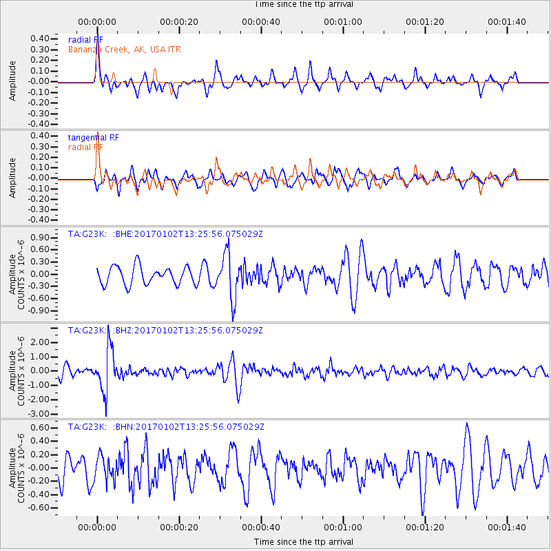
G23K Bananza Creek, AK, USA - Earthquake Result Viewer
*The percent match for this event was below the threshold and hence no stack was calculated.
| Earthquake location: |
Northern Peru |
| Earthquake latitude/longitude: |
-4.9/-76.3 |
| Earthquake time(UTC): |
2017/01/02 (002) 13:13:48 GMT |
| Earthquake Depth: |
108 km |
| Earthquake Magnitude: |
5.9 Mwb |
| Earthquake Catalog/Contributor: |
NEIC PDE/us |
|
| Network: |
TA USArray Transportable Network (new EarthScope stations) |
| Station: |
G23K Bananza Creek, AK, USA |
| Lat/Lon: |
66.71 N/150.02 W |
| Elevation: |
746 m |
|
| Distance: |
88.1 deg |
| Az: |
337.554 deg |
| Baz: |
106.899 deg |
| Ray Param: |
$rayparam |
*The percent match for this event was below the threshold and hence was not used in the summary stack. |
|
| Radial Match: |
76.617645 % |
| Radial Bump: |
400 |
| Transverse Match: |
54.326572 % |
| Transverse Bump: |
393 |
| SOD ConfigId: |
11737051 |
| Insert Time: |
2019-04-26 12:08:25.709 +0000 |
| GWidth: |
2.5 |
| Max Bumps: |
400 |
| Tol: |
0.001 |
|
Signal To Noise
| Channel | StoN | STA | LTA |
| TA:G23K: :BHZ:20170102T13:25:56.075029Z | 6.328865 | 1.4933152E-6 | 2.3595307E-7 |
| TA:G23K: :BHN:20170102T13:25:56.075029Z | 0.6923158 | 1.7454242E-7 | 2.5211386E-7 |
| TA:G23K: :BHE:20170102T13:25:56.075029Z | 2.5363185 | 5.518814E-7 | 2.1759152E-7 |
| Arrivals |
| Ps | |
| PpPs | |
| PsPs/PpSs | |


