You are here: Home > Network List > TA - USArray Transportable Network (new EarthScope stations) Stations List
> Station J26L Joseph Creek, AK, USA > Earthquake Result Viewer
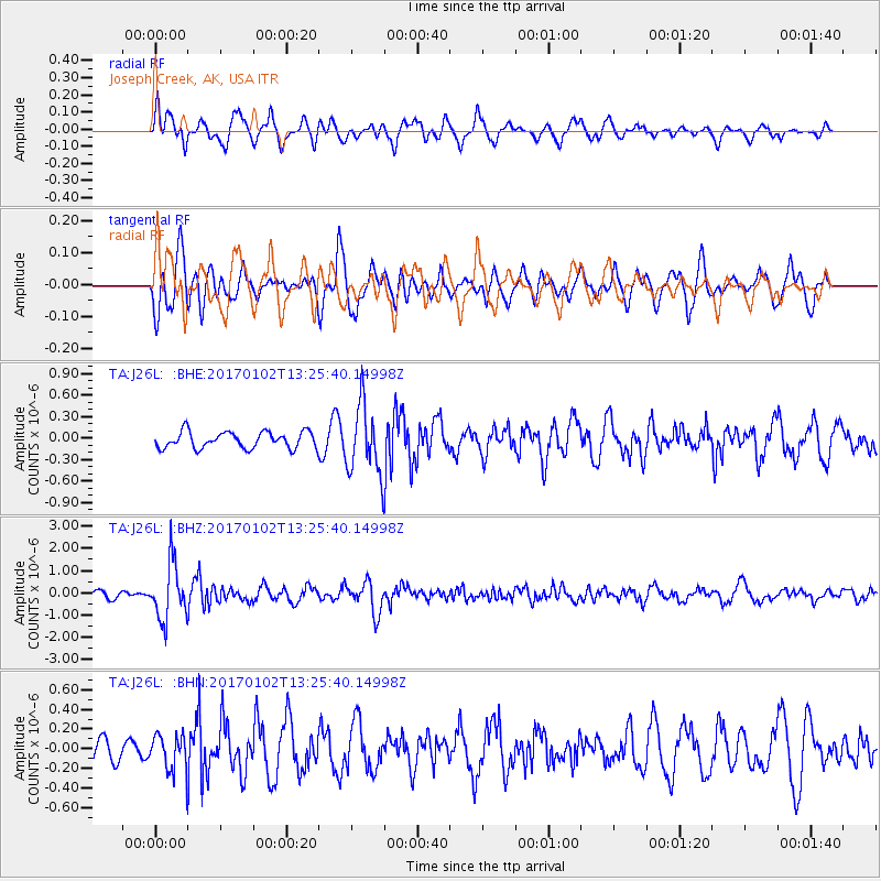
J26L Joseph Creek, AK, USA - Earthquake Result Viewer
*The percent match for this event was below the threshold and hence no stack was calculated.
| Earthquake location: |
Northern Peru |
| Earthquake latitude/longitude: |
-4.9/-76.3 |
| Earthquake time(UTC): |
2017/01/02 (002) 13:13:48 GMT |
| Earthquake Depth: |
108 km |
| Earthquake Magnitude: |
5.9 Mwb |
| Earthquake Catalog/Contributor: |
NEIC PDE/us |
|
| Network: |
TA USArray Transportable Network (new EarthScope stations) |
| Station: |
J26L Joseph Creek, AK, USA |
| Lat/Lon: |
64.50 N/143.56 W |
| Elevation: |
1144 m |
|
| Distance: |
84.8 deg |
| Az: |
336.375 deg |
| Baz: |
112.705 deg |
| Ray Param: |
$rayparam |
*The percent match for this event was below the threshold and hence was not used in the summary stack. |
|
| Radial Match: |
62.321915 % |
| Radial Bump: |
400 |
| Transverse Match: |
68.94501 % |
| Transverse Bump: |
400 |
| SOD ConfigId: |
11737051 |
| Insert Time: |
2019-04-26 12:08:41.803 +0000 |
| GWidth: |
2.5 |
| Max Bumps: |
400 |
| Tol: |
0.001 |
|
Signal To Noise
| Channel | StoN | STA | LTA |
| TA:J26L: :BHZ:20170102T13:25:40.14998Z | 8.408921 | 1.2707748E-6 | 1.5112221E-7 |
| TA:J26L: :BHN:20170102T13:25:40.14998Z | 1.5531069 | 1.7695383E-7 | 1.13935386E-7 |
| TA:J26L: :BHE:20170102T13:25:40.14998Z | 4.1860666 | 4.7578632E-7 | 1.1365952E-7 |
| Arrivals |
| Ps | |
| PpPs | |
| PsPs/PpSs | |


