You are here: Home > Network List > TA - USArray Transportable Network (new EarthScope stations) Stations List
> Station L44A Lake County Forest Preserve, Grayslake, IL, USA > Earthquake Result Viewer
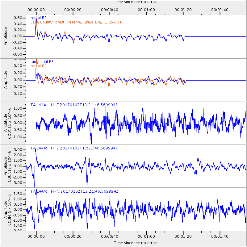
L44A Lake County Forest Preserve, Grayslake, IL, USA - Earthquake Result Viewer
*The percent match for this event was below the threshold and hence no stack was calculated.
| Earthquake location: |
Northern Peru |
| Earthquake latitude/longitude: |
-4.9/-76.3 |
| Earthquake time(UTC): |
2017/01/02 (002) 13:13:48 GMT |
| Earthquake Depth: |
108 km |
| Earthquake Magnitude: |
5.9 Mwb |
| Earthquake Catalog/Contributor: |
NEIC PDE/us |
|
| Network: |
TA USArray Transportable Network (new EarthScope stations) |
| Station: |
L44A Lake County Forest Preserve, Grayslake, IL, USA |
| Lat/Lon: |
42.18 N/87.91 W |
| Elevation: |
202 m |
|
| Distance: |
48.0 deg |
| Az: |
348.429 deg |
| Baz: |
164.402 deg |
| Ray Param: |
$rayparam |
*The percent match for this event was below the threshold and hence was not used in the summary stack. |
|
| Radial Match: |
64.107086 % |
| Radial Bump: |
400 |
| Transverse Match: |
76.34056 % |
| Transverse Bump: |
400 |
| SOD ConfigId: |
11737051 |
| Insert Time: |
2019-04-26 12:08:50.398 +0000 |
| GWidth: |
2.5 |
| Max Bumps: |
400 |
| Tol: |
0.001 |
|
Signal To Noise
| Channel | StoN | STA | LTA |
| TA:L44A: :HHZ:20170102T13:21:46.569994Z | 2.8553352 | 1.3063914E-6 | 4.5752645E-7 |
| TA:L44A: :HHN:20170102T13:21:46.569994Z | 2.8834236 | 8.657025E-7 | 3.0023423E-7 |
| TA:L44A: :HHE:20170102T13:21:46.569994Z | 1.6508396 | 4.853655E-7 | 2.9401127E-7 |
| Arrivals |
| Ps | |
| PpPs | |
| PsPs/PpSs | |


