You are here: Home > Network List > TA - USArray Transportable Network (new EarthScope stations) Stations List
> Station MDND Maddock, ND, USA > Earthquake Result Viewer
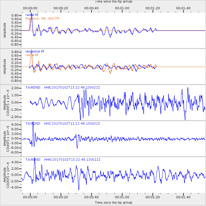
MDND Maddock, ND, USA - Earthquake Result Viewer
*The percent match for this event was below the threshold and hence no stack was calculated.
| Earthquake location: |
Northern Peru |
| Earthquake latitude/longitude: |
-4.9/-76.3 |
| Earthquake time(UTC): |
2017/01/02 (002) 13:13:48 GMT |
| Earthquake Depth: |
108 km |
| Earthquake Magnitude: |
5.9 Mwb |
| Earthquake Catalog/Contributor: |
NEIC PDE/us |
|
| Network: |
TA USArray Transportable Network (new EarthScope stations) |
| Station: |
MDND Maddock, ND, USA |
| Lat/Lon: |
47.85 N/99.60 W |
| Elevation: |
479 m |
|
| Distance: |
56.4 deg |
| Az: |
341.365 deg |
| Baz: |
151.791 deg |
| Ray Param: |
$rayparam |
*The percent match for this event was below the threshold and hence was not used in the summary stack. |
|
| Radial Match: |
76.128456 % |
| Radial Bump: |
273 |
| Transverse Match: |
73.9935 % |
| Transverse Bump: |
398 |
| SOD ConfigId: |
11737051 |
| Insert Time: |
2019-04-26 12:08:59.670 +0000 |
| GWidth: |
2.5 |
| Max Bumps: |
400 |
| Tol: |
0.001 |
|
Signal To Noise
| Channel | StoN | STA | LTA |
| TA:MDND: :HHZ:20170102T13:22:48.130022Z | 23.586946 | 3.6771419E-6 | 1.5589733E-7 |
| TA:MDND: :HHN:20170102T13:22:48.130022Z | 3.7750196 | 1.9960796E-6 | 5.2876004E-7 |
| TA:MDND: :HHE:20170102T13:22:48.130022Z | 2.784308 | 9.788661E-7 | 3.515653E-7 |
| Arrivals |
| Ps | |
| PpPs | |
| PsPs/PpSs | |


