You are here: Home > Network List > UW - Pacific Northwest Regional Seismic Network Stations List
> Station HOOD Mt Hood Meadows, OR CREST BB SMO > Earthquake Result Viewer
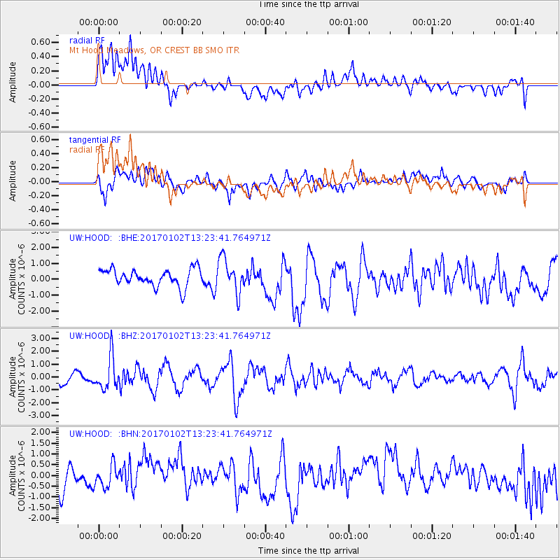
HOOD Mt Hood Meadows, OR CREST BB SMO - Earthquake Result Viewer
*The percent match for this event was below the threshold and hence no stack was calculated.
| Earthquake location: |
Northern Peru |
| Earthquake latitude/longitude: |
-4.9/-76.3 |
| Earthquake time(UTC): |
2017/01/02 (002) 13:13:48 GMT |
| Earthquake Depth: |
108 km |
| Earthquake Magnitude: |
5.9 Mwb |
| Earthquake Catalog/Contributor: |
NEIC PDE/us |
|
| Network: |
UW Pacific Northwest Regional Seismic Network |
| Station: |
HOOD Mt Hood Meadows, OR CREST BB SMO |
| Lat/Lon: |
45.32 N/121.65 W |
| Elevation: |
1520 m |
|
| Distance: |
64.3 deg |
| Az: |
326.161 deg |
| Baz: |
128.143 deg |
| Ray Param: |
$rayparam |
*The percent match for this event was below the threshold and hence was not used in the summary stack. |
|
| Radial Match: |
56.069695 % |
| Radial Bump: |
400 |
| Transverse Match: |
60.589108 % |
| Transverse Bump: |
400 |
| SOD ConfigId: |
11737051 |
| Insert Time: |
2019-04-26 12:10:17.242 +0000 |
| GWidth: |
2.5 |
| Max Bumps: |
400 |
| Tol: |
0.001 |
|
Signal To Noise
| Channel | StoN | STA | LTA |
| UW:HOOD: :BHZ:20170102T13:23:41.764971Z | 3.275096 | 1.3080719E-6 | 3.9939954E-7 |
| UW:HOOD: :BHN:20170102T13:23:41.764971Z | 0.74691004 | 5.5823284E-7 | 7.473897E-7 |
| UW:HOOD: :BHE:20170102T13:23:41.764971Z | 2.0084732 | 1.0823338E-6 | 5.3888385E-7 |
| Arrivals |
| Ps | |
| PpPs | |
| PsPs/PpSs | |


