You are here: Home > Network List > AV - Alaska Volcano Observatory Stations List
> Station AMKA Regional Station, Amchitka Island, Alaska > Earthquake Result Viewer
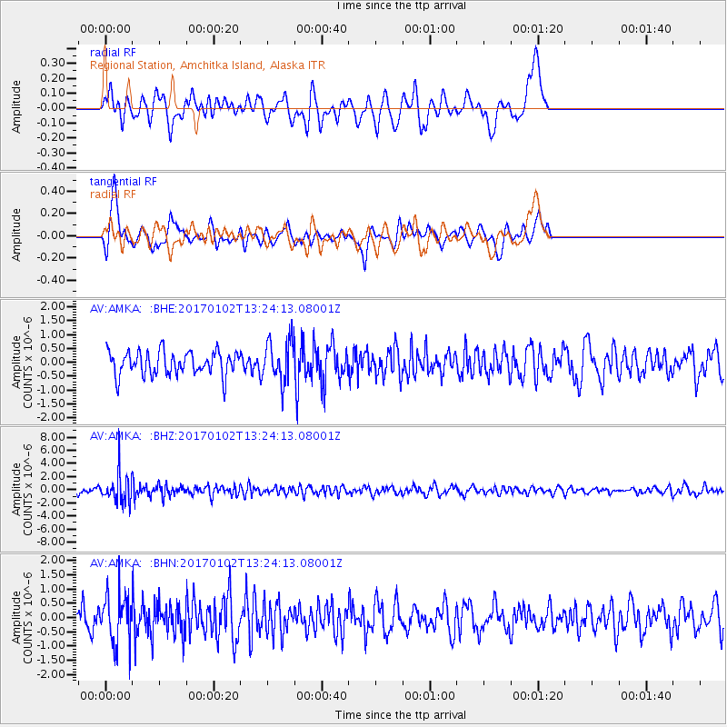
AMKA Regional Station, Amchitka Island, Alaska - Earthquake Result Viewer
*The percent match for this event was below the threshold and hence no stack was calculated.
| Earthquake location: |
South Of Fiji Islands |
| Earthquake latitude/longitude: |
-23.3/179.3 |
| Earthquake time(UTC): |
2017/01/02 (002) 13:14:02 GMT |
| Earthquake Depth: |
555 km |
| Earthquake Magnitude: |
6.3 Mwb |
| Earthquake Catalog/Contributor: |
NEIC PDE/us |
|
| Network: |
AV Alaska Volcano Observatory |
| Station: |
AMKA Regional Station, Amchitka Island, Alaska |
| Lat/Lon: |
51.38 N/179.30 E |
| Elevation: |
116 m |
|
| Distance: |
74.4 deg |
| Az: |
359.997 deg |
| Baz: |
179.996 deg |
| Ray Param: |
$rayparam |
*The percent match for this event was below the threshold and hence was not used in the summary stack. |
|
| Radial Match: |
48.215675 % |
| Radial Bump: |
400 |
| Transverse Match: |
57.78321 % |
| Transverse Bump: |
340 |
| SOD ConfigId: |
11737051 |
| Insert Time: |
2019-04-26 12:15:13.000 +0000 |
| GWidth: |
2.5 |
| Max Bumps: |
400 |
| Tol: |
0.001 |
|
Signal To Noise
| Channel | StoN | STA | LTA |
| AV:AMKA: :BHZ:20170102T13:24:13.08001Z | 4.1514306 | 2.2561808E-6 | 5.4347066E-7 |
| AV:AMKA: :BHN:20170102T13:24:13.08001Z | 2.355354 | 8.6485926E-7 | 3.6718865E-7 |
| AV:AMKA: :BHE:20170102T13:24:13.08001Z | 1.7962755 | 7.6195977E-7 | 4.241887E-7 |
| Arrivals |
| Ps | |
| PpPs | |
| PsPs/PpSs | |


