You are here: Home > Network List > TA - USArray Transportable Network (new EarthScope stations) Stations List
> Station A21K Barrow, AK, USA > Earthquake Result Viewer
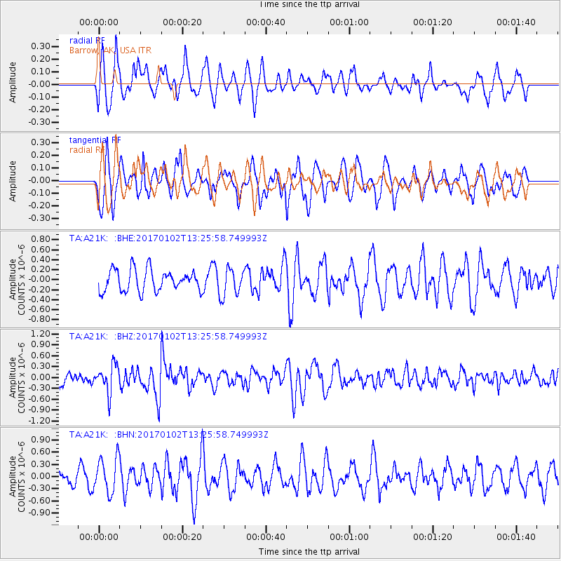
A21K Barrow, AK, USA - Earthquake Result Viewer
*The percent match for this event was below the threshold and hence no stack was calculated.
| Earthquake location: |
South Of Fiji Islands |
| Earthquake latitude/longitude: |
-23.3/179.3 |
| Earthquake time(UTC): |
2017/01/02 (002) 13:14:02 GMT |
| Earthquake Depth: |
555 km |
| Earthquake Magnitude: |
6.3 Mwb |
| Earthquake Catalog/Contributor: |
NEIC PDE/us |
|
| Network: |
TA USArray Transportable Network (new EarthScope stations) |
| Station: |
A21K Barrow, AK, USA |
| Lat/Lon: |
71.32 N/156.62 W |
| Elevation: |
577 m |
|
| Distance: |
95.9 deg |
| Az: |
7.593 deg |
| Baz: |
202.145 deg |
| Ray Param: |
$rayparam |
*The percent match for this event was below the threshold and hence was not used in the summary stack. |
|
| Radial Match: |
55.70903 % |
| Radial Bump: |
400 |
| Transverse Match: |
58.13417 % |
| Transverse Bump: |
327 |
| SOD ConfigId: |
11737051 |
| Insert Time: |
2019-04-26 12:18:54.285 +0000 |
| GWidth: |
2.5 |
| Max Bumps: |
400 |
| Tol: |
0.001 |
|
Signal To Noise
| Channel | StoN | STA | LTA |
| TA:A21K: :BHZ:20170102T13:25:58.749993Z | 2.934268 | 3.8883513E-7 | 1.3251521E-7 |
| TA:A21K: :BHN:20170102T13:25:58.749993Z | 2.273525 | 4.42169E-7 | 1.944861E-7 |
| TA:A21K: :BHE:20170102T13:25:58.749993Z | 1.273331 | 2.755328E-7 | 2.163874E-7 |
| Arrivals |
| Ps | |
| PpPs | |
| PsPs/PpSs | |


