You are here: Home > Network List > TA - USArray Transportable Network (new EarthScope stations) Stations List
> Station O28M Mount Upton, YT, CAN > Earthquake Result Viewer
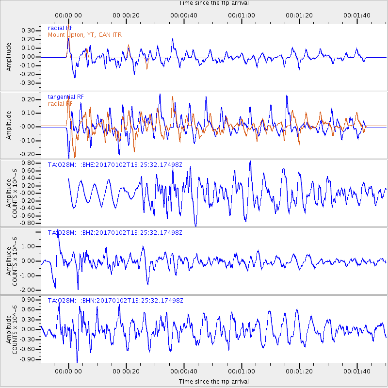
O28M Mount Upton, YT, CAN - Earthquake Result Viewer
*The percent match for this event was below the threshold and hence no stack was calculated.
| Earthquake location: |
South Of Fiji Islands |
| Earthquake latitude/longitude: |
-23.3/179.3 |
| Earthquake time(UTC): |
2017/01/02 (002) 13:14:02 GMT |
| Earthquake Depth: |
555 km |
| Earthquake Magnitude: |
6.3 Mwb |
| Earthquake Catalog/Contributor: |
NEIC PDE/us |
|
| Network: |
TA USArray Transportable Network (new EarthScope stations) |
| Station: |
O28M Mount Upton, YT, CAN |
| Lat/Lon: |
60.77 N/140.19 W |
| Elevation: |
2622 m |
|
| Distance: |
90.0 deg |
| Az: |
18.588 deg |
| Baz: |
216.654 deg |
| Ray Param: |
$rayparam |
*The percent match for this event was below the threshold and hence was not used in the summary stack. |
|
| Radial Match: |
68.809685 % |
| Radial Bump: |
400 |
| Transverse Match: |
73.731 % |
| Transverse Bump: |
400 |
| SOD ConfigId: |
11737051 |
| Insert Time: |
2019-04-26 12:19:33.090 +0000 |
| GWidth: |
2.5 |
| Max Bumps: |
400 |
| Tol: |
0.001 |
|
Signal To Noise
| Channel | StoN | STA | LTA |
| TA:O28M: :BHZ:20170102T13:25:32.17498Z | 1.8927983 | 5.326662E-7 | 2.814173E-7 |
| TA:O28M: :BHN:20170102T13:25:32.17498Z | 2.2975285 | 3.8187116E-7 | 1.6620955E-7 |
| TA:O28M: :BHE:20170102T13:25:32.17498Z | 1.5121925 | 3.1075623E-7 | 2.0550046E-7 |
| Arrivals |
| Ps | |
| PpPs | |
| PsPs/PpSs | |


