You are here: Home > Network List > TA - USArray Transportable Network (new EarthScope stations) Stations List
> Station V35K Ketchikan, AK, USA > Earthquake Result Viewer
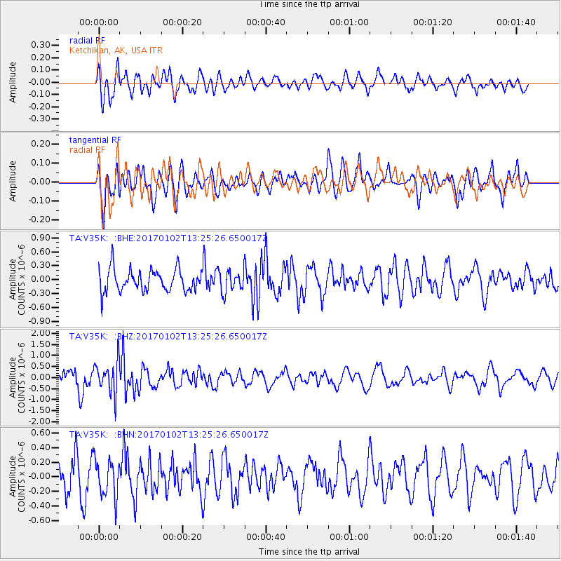
V35K Ketchikan, AK, USA - Earthquake Result Viewer
*The percent match for this event was below the threshold and hence no stack was calculated.
| Earthquake location: |
South Of Fiji Islands |
| Earthquake latitude/longitude: |
-23.3/179.3 |
| Earthquake time(UTC): |
2017/01/02 (002) 13:14:02 GMT |
| Earthquake Depth: |
555 km |
| Earthquake Magnitude: |
6.3 Mwb |
| Earthquake Catalog/Contributor: |
NEIC PDE/us |
|
| Network: |
TA USArray Transportable Network (new EarthScope stations) |
| Station: |
V35K Ketchikan, AK, USA |
| Lat/Lon: |
55.33 N/131.62 W |
| Elevation: |
64 m |
|
| Distance: |
88.8 deg |
| Az: |
25.588 deg |
| Baz: |
224.002 deg |
| Ray Param: |
$rayparam |
*The percent match for this event was below the threshold and hence was not used in the summary stack. |
|
| Radial Match: |
58.55647 % |
| Radial Bump: |
400 |
| Transverse Match: |
52.260418 % |
| Transverse Bump: |
400 |
| SOD ConfigId: |
11737051 |
| Insert Time: |
2019-04-26 12:19:47.953 +0000 |
| GWidth: |
2.5 |
| Max Bumps: |
400 |
| Tol: |
0.001 |
|
Signal To Noise
| Channel | StoN | STA | LTA |
| TA:V35K: :BHZ:20170102T13:25:26.650017Z | 3.5039508 | 7.418599E-7 | 2.1172097E-7 |
| TA:V35K: :BHN:20170102T13:25:26.650017Z | 1.3384879 | 2.5316868E-7 | 1.891453E-7 |
| TA:V35K: :BHE:20170102T13:25:26.650017Z | 0.917124 | 2.1955067E-7 | 2.393904E-7 |
| Arrivals |
| Ps | |
| PpPs | |
| PsPs/PpSs | |


