You are here: Home > Network List > UW - Pacific Northwest Regional Seismic Network Stations List
> Station HOOD Mt Hood Meadows, OR CREST BB SMO > Earthquake Result Viewer
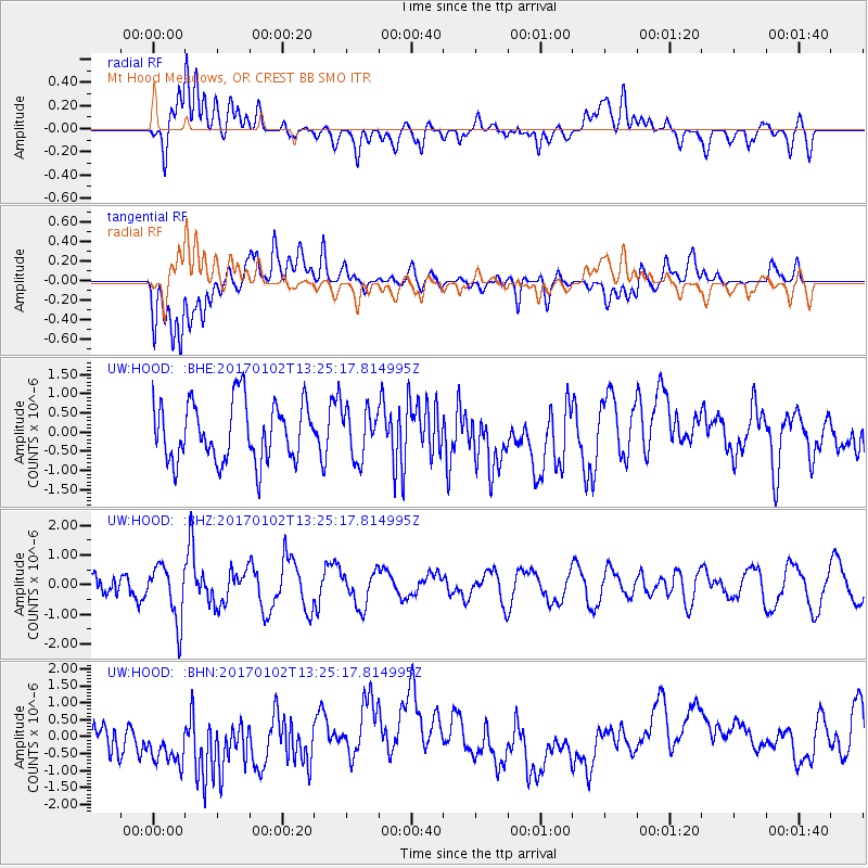
HOOD Mt Hood Meadows, OR CREST BB SMO - Earthquake Result Viewer
*The percent match for this event was below the threshold and hence no stack was calculated.
| Earthquake location: |
South Of Fiji Islands |
| Earthquake latitude/longitude: |
-23.3/179.3 |
| Earthquake time(UTC): |
2017/01/02 (002) 13:14:02 GMT |
| Earthquake Depth: |
555 km |
| Earthquake Magnitude: |
6.3 Mwb |
| Earthquake Catalog/Contributor: |
NEIC PDE/us |
|
| Network: |
UW Pacific Northwest Regional Seismic Network |
| Station: |
HOOD Mt Hood Meadows, OR CREST BB SMO |
| Lat/Lon: |
45.32 N/121.65 W |
| Elevation: |
1520 m |
|
| Distance: |
86.9 deg |
| Az: |
37.293 deg |
| Baz: |
232.128 deg |
| Ray Param: |
$rayparam |
*The percent match for this event was below the threshold and hence was not used in the summary stack. |
|
| Radial Match: |
61.81932 % |
| Radial Bump: |
400 |
| Transverse Match: |
34.432777 % |
| Transverse Bump: |
400 |
| SOD ConfigId: |
11737051 |
| Insert Time: |
2019-04-26 12:20:19.306 +0000 |
| GWidth: |
2.5 |
| Max Bumps: |
400 |
| Tol: |
0.001 |
|
Signal To Noise
| Channel | StoN | STA | LTA |
| UW:HOOD: :BHZ:20170102T13:25:17.814995Z | 2.226072 | 9.264328E-7 | 4.1617378E-7 |
| UW:HOOD: :BHN:20170102T13:25:17.814995Z | 1.4033207 | 1.1919088E-6 | 8.493489E-7 |
| UW:HOOD: :BHE:20170102T13:25:17.814995Z | 0.89147776 | 6.778817E-7 | 7.6040226E-7 |
| Arrivals |
| Ps | |
| PpPs | |
| PsPs/PpSs | |


