You are here: Home > Network List > UW - Pacific Northwest Regional Seismic Network Stations List
> Station UMAT Pilot Rock, OR, USA > Earthquake Result Viewer
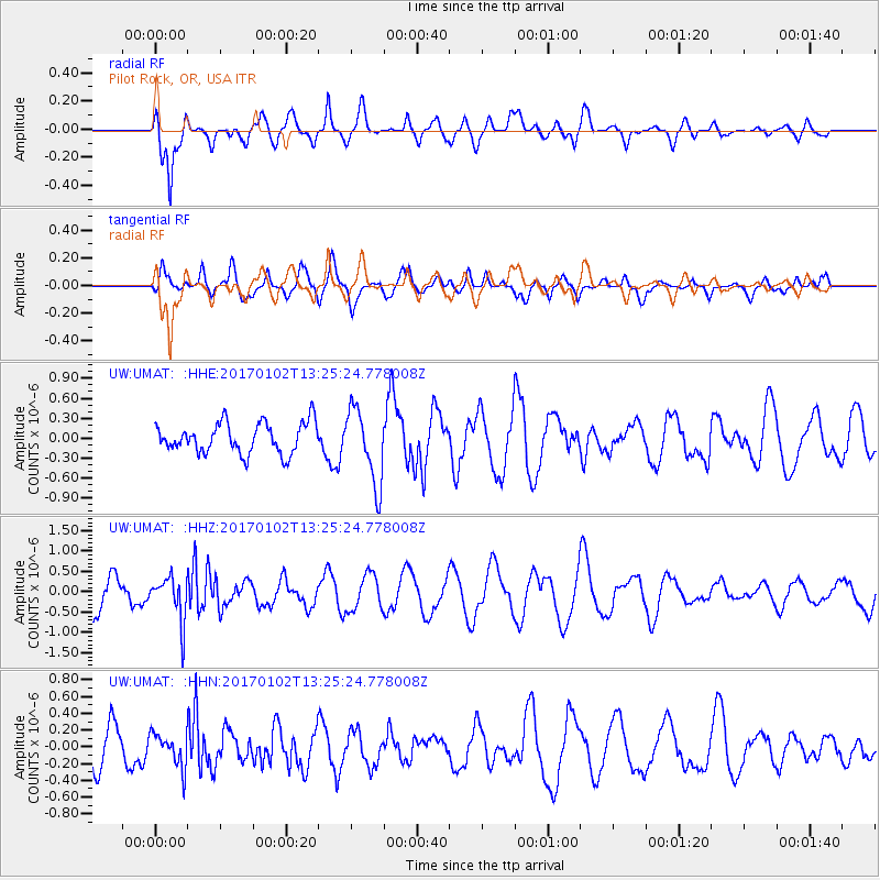
UMAT Pilot Rock, OR, USA - Earthquake Result Viewer
*The percent match for this event was below the threshold and hence no stack was calculated.
| Earthquake location: |
South Of Fiji Islands |
| Earthquake latitude/longitude: |
-23.3/179.3 |
| Earthquake time(UTC): |
2017/01/02 (002) 13:14:02 GMT |
| Earthquake Depth: |
555 km |
| Earthquake Magnitude: |
6.3 Mwb |
| Earthquake Catalog/Contributor: |
NEIC PDE/us |
|
| Network: |
UW Pacific Northwest Regional Seismic Network |
| Station: |
UMAT Pilot Rock, OR, USA |
| Lat/Lon: |
45.29 N/118.96 W |
| Elevation: |
1318 m |
|
| Distance: |
88.4 deg |
| Az: |
38.46 deg |
| Baz: |
234.085 deg |
| Ray Param: |
$rayparam |
*The percent match for this event was below the threshold and hence was not used in the summary stack. |
|
| Radial Match: |
67.0124 % |
| Radial Bump: |
400 |
| Transverse Match: |
49.767628 % |
| Transverse Bump: |
400 |
| SOD ConfigId: |
11737051 |
| Insert Time: |
2019-04-26 12:20:23.709 +0000 |
| GWidth: |
2.5 |
| Max Bumps: |
400 |
| Tol: |
0.001 |
|
Signal To Noise
| Channel | StoN | STA | LTA |
| UW:UMAT: :HHZ:20170102T13:25:24.778008Z | 1.3097923 | 5.255168E-7 | 4.0122146E-7 |
| UW:UMAT: :HHN:20170102T13:25:24.778008Z | 0.6655274 | 2.0113603E-7 | 3.0222049E-7 |
| UW:UMAT: :HHE:20170102T13:25:24.778008Z | 2.4693673 | 5.620688E-7 | 2.2761654E-7 |
| Arrivals |
| Ps | |
| PpPs | |
| PsPs/PpSs | |


