You are here: Home > Network List > CN - Canadian National Seismograph Network Stations List
> Station INK INUVIK, NT > Earthquake Result Viewer
INK INUVIK, NT - Earthquake Result Viewer
*The percent match for this event was below the threshold and hence no stack was calculated.
| Earthquake location: |
India-Bangladesh Border Region |
| Earthquake latitude/longitude: |
24.0/92.0 |
| Earthquake time(UTC): |
2017/01/03 (003) 09:09:02 GMT |
| Earthquake Depth: |
36 km |
| Earthquake Magnitude: |
5.5 mb |
| Earthquake Catalog/Contributor: |
NEIC PDE/us |
|
| Network: |
CN Canadian National Seismograph Network |
| Station: |
INK INUVIK, NT |
| Lat/Lon: |
68.31 N/133.53 W |
| Elevation: |
44 m |
|
| Distance: |
82.1 deg |
| Az: |
15.537 deg |
| Baz: |
318.788 deg |
| Ray Param: |
$rayparam |
*The percent match for this event was below the threshold and hence was not used in the summary stack. |
|
| Radial Match: |
52.355976 % |
| Radial Bump: |
400 |
| Transverse Match: |
39.925476 % |
| Transverse Bump: |
334 |
| SOD ConfigId: |
11737051 |
| Insert Time: |
2019-04-26 12:23:07.737 +0000 |
| GWidth: |
2.5 |
| Max Bumps: |
400 |
| Tol: |
0.001 |
|
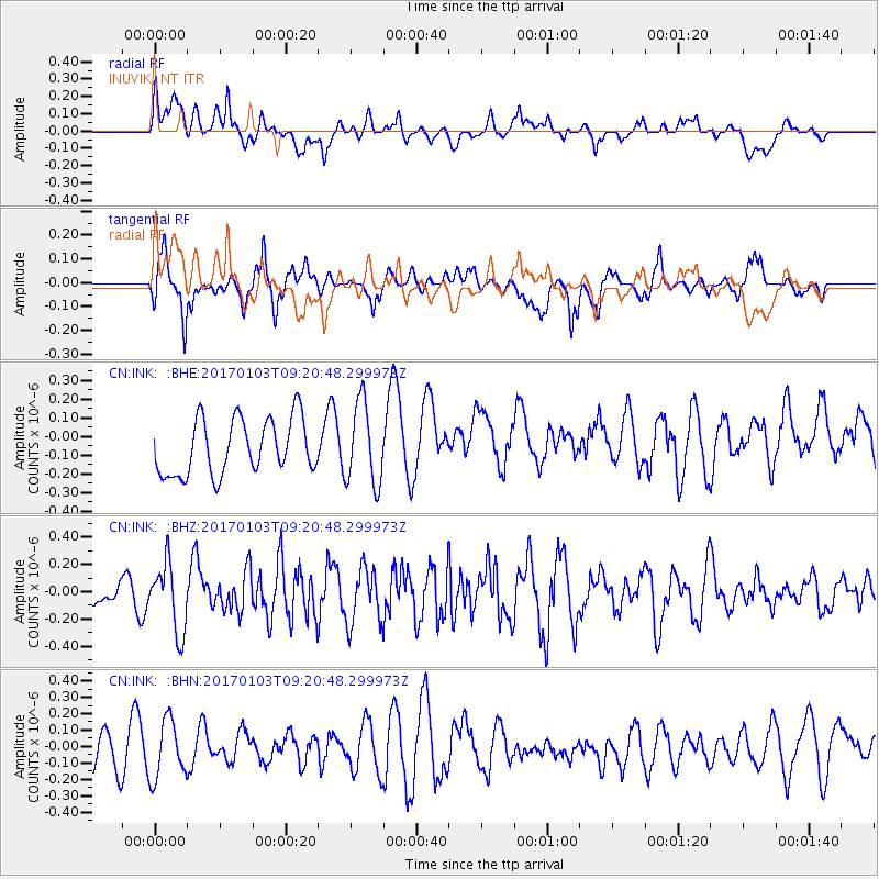
Signal To Noise
| Channel | StoN | STA | LTA |
| CN:INK: :BHZ:20170103T09:20:48.299973Z | 1.3951691 | 2.509685E-7 | 1.7988393E-7 |
| CN:INK: :BHN:20170103T09:20:48.299973Z | 1.1657571 | 1.7872927E-7 | 1.5331605E-7 |
| CN:INK: :BHE:20170103T09:20:48.299973Z | 1.4745378 | 2.1903885E-7 | 1.4854747E-7 |
| Arrivals |
| Ps | |
| PpPs | |
| PsPs/PpSs | |


