You are here: Home > Network List > IW - Intermountain West Stations List
> Station PLID Pearl Lake, Idaho, USA > Earthquake Result Viewer
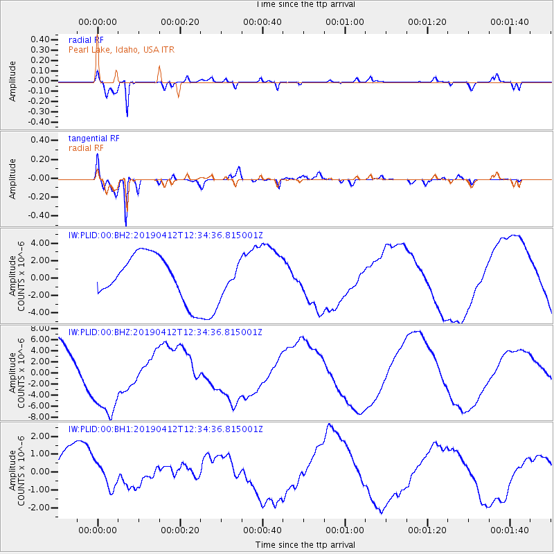
PLID Pearl Lake, Idaho, USA - Earthquake Result Viewer
*The percent match for this event was below the threshold and hence no stack was calculated.
| Earthquake location: |
Samoa Islands Region |
| Earthquake latitude/longitude: |
-15.4/-172.7 |
| Earthquake time(UTC): |
2019/04/12 (102) 12:23:03 GMT |
| Earthquake Depth: |
10 km |
| Earthquake Magnitude: |
5.8 mb |
| Earthquake Catalog/Contributor: |
NEIC PDE/us |
|
| Network: |
IW Intermountain West |
| Station: |
PLID Pearl Lake, Idaho, USA |
| Lat/Lon: |
45.09 N/116.00 W |
| Elevation: |
2164 m |
|
| Distance: |
79.1 deg |
| Az: |
37.087 deg |
| Baz: |
235.192 deg |
| Ray Param: |
$rayparam |
*The percent match for this event was below the threshold and hence was not used in the summary stack. |
|
| Radial Match: |
95.97546 % |
| Radial Bump: |
396 |
| Transverse Match: |
95.58782 % |
| Transverse Bump: |
400 |
| SOD ConfigId: |
11735903 |
| Insert Time: |
2019-04-26 12:31:43.118 +0000 |
| GWidth: |
2.5 |
| Max Bumps: |
400 |
| Tol: |
0.001 |
|
Signal To Noise
| Channel | StoN | STA | LTA |
| IW:PLID:00:BHZ:20190412T12:34:36.815001Z | 1.7031989 | 6.946734E-6 | 4.0786394E-6 |
| IW:PLID:00:BH1:20190412T12:34:36.815001Z | 0.5118177 | 6.830923E-7 | 1.3346399E-6 |
| IW:PLID:00:BH2:20190412T12:34:36.815001Z | 0.71252733 | 1.799785E-6 | 2.5259171E-6 |
| Arrivals |
| Ps | |
| PpPs | |
| PsPs/PpSs | |


