You are here: Home > Network List > US - United States National Seismic Network Stations List
> Station EGMT Eagleton, Montana, USA > Earthquake Result Viewer
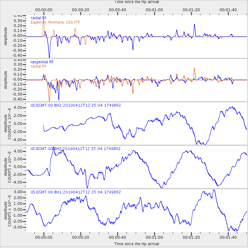
EGMT Eagleton, Montana, USA - Earthquake Result Viewer
*The percent match for this event was below the threshold and hence no stack was calculated.
| Earthquake location: |
Samoa Islands Region |
| Earthquake latitude/longitude: |
-15.4/-172.7 |
| Earthquake time(UTC): |
2019/04/12 (102) 12:23:03 GMT |
| Earthquake Depth: |
10 km |
| Earthquake Magnitude: |
5.8 mb |
| Earthquake Catalog/Contributor: |
NEIC PDE/us |
|
| Network: |
US United States National Seismic Network |
| Station: |
EGMT Eagleton, Montana, USA |
| Lat/Lon: |
48.02 N/109.75 W |
| Elevation: |
1055 m |
|
| Distance: |
84.3 deg |
| Az: |
36.932 deg |
| Baz: |
239.694 deg |
| Ray Param: |
$rayparam |
*The percent match for this event was below the threshold and hence was not used in the summary stack. |
|
| Radial Match: |
78.87087 % |
| Radial Bump: |
400 |
| Transverse Match: |
96.09642 % |
| Transverse Bump: |
323 |
| SOD ConfigId: |
11735903 |
| Insert Time: |
2019-04-26 12:35:20.740 +0000 |
| GWidth: |
2.5 |
| Max Bumps: |
400 |
| Tol: |
0.001 |
|
Signal To Noise
| Channel | StoN | STA | LTA |
| US:EGMT:00:BHZ:20190412T12:35:04.174986Z | 2.6414719 | 1.7942713E-6 | 6.7926953E-7 |
| US:EGMT:00:BH1:20190412T12:35:04.174986Z | 3.4142735 | 2.5611928E-6 | 7.501428E-7 |
| US:EGMT:00:BH2:20190412T12:35:04.174986Z | 2.8945932 | 2.1890676E-6 | 7.562608E-7 |
| Arrivals |
| Ps | |
| PpPs | |
| PsPs/PpSs | |


