You are here: Home > Network List > US - United States National Seismic Network Stations List
> Station MSO Missoula, Montana, USA > Earthquake Result Viewer
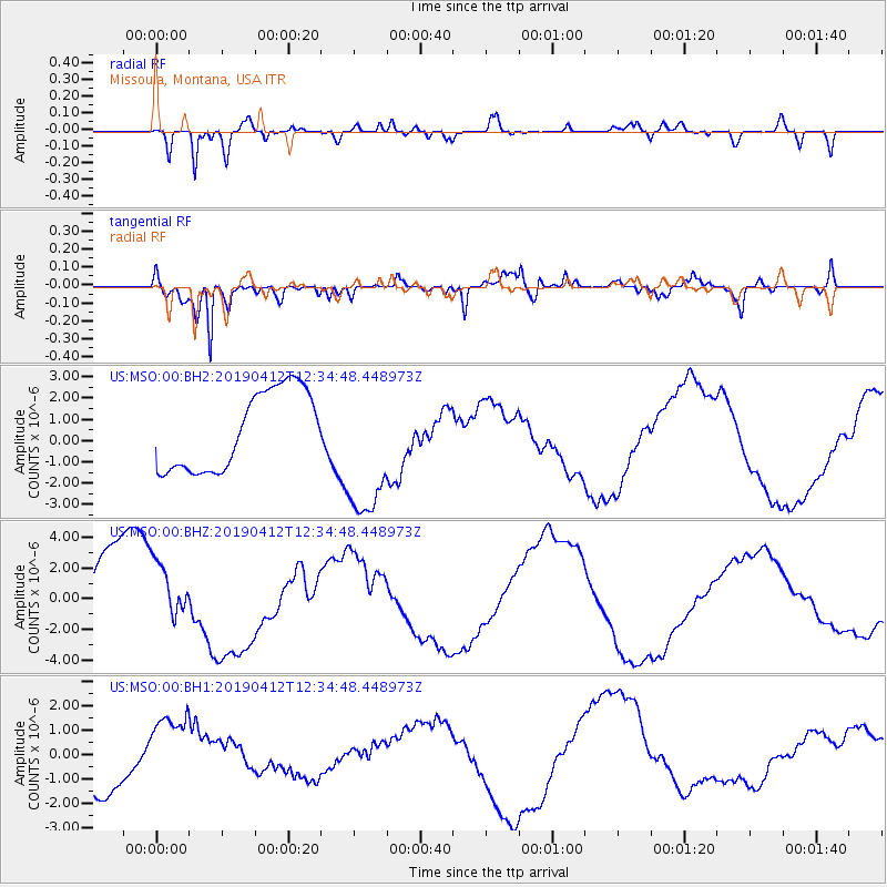
MSO Missoula, Montana, USA - Earthquake Result Viewer
*The percent match for this event was below the threshold and hence no stack was calculated.
| Earthquake location: |
Samoa Islands Region |
| Earthquake latitude/longitude: |
-15.4/-172.7 |
| Earthquake time(UTC): |
2019/04/12 (102) 12:23:03 GMT |
| Earthquake Depth: |
10 km |
| Earthquake Magnitude: |
5.8 mb |
| Earthquake Catalog/Contributor: |
NEIC PDE/us |
|
| Network: |
US United States National Seismic Network |
| Station: |
MSO Missoula, Montana, USA |
| Lat/Lon: |
46.83 N/113.94 W |
| Elevation: |
1264 m |
|
| Distance: |
81.3 deg |
| Az: |
36.442 deg |
| Baz: |
236.559 deg |
| Ray Param: |
$rayparam |
*The percent match for this event was below the threshold and hence was not used in the summary stack. |
|
| Radial Match: |
88.742905 % |
| Radial Bump: |
400 |
| Transverse Match: |
94.31234 % |
| Transverse Bump: |
396 |
| SOD ConfigId: |
11735903 |
| Insert Time: |
2019-04-26 12:35:37.625 +0000 |
| GWidth: |
2.5 |
| Max Bumps: |
400 |
| Tol: |
0.001 |
|
Signal To Noise
| Channel | StoN | STA | LTA |
| US:MSO:00:BHZ:20190412T12:34:48.448973Z | 0.86001545 | 2.1179087E-6 | 2.4626404E-6 |
| US:MSO:00:BH1:20190412T12:34:48.448973Z | 1.1270025 | 1.4291824E-6 | 1.2681271E-6 |
| US:MSO:00:BH2:20190412T12:34:48.448973Z | 1.794763 | 3.3315287E-6 | 1.8562499E-6 |
| Arrivals |
| Ps | |
| PpPs | |
| PsPs/PpSs | |


