MUR Murrieta - Earthquake Result Viewer
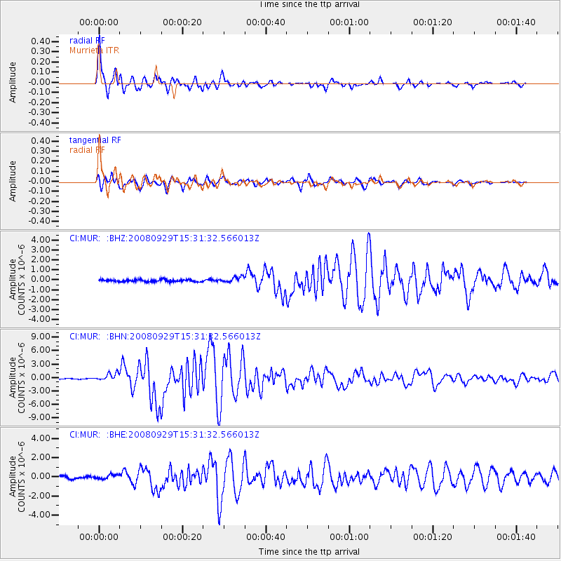
Earthquake location: Kermadec Islands, New Zealand
Earthquake latitude/longitude: -29.8/-177.7
Earthquake time(UTC): 2008/09/29 (273) 15:19:31 GMT
Earthquake Depth: 36 km
Earthquake Magnitude: 6.5 MB, 6.7 MS, 7.0 MW, 7.0 MW
Earthquake Catalog/Contributor: WHDF/NEIC
Network: CI Caltech Regional Seismic Network
Station: MUR Murrieta
Lat/Lon: 33.60 N/117.20 W
Elevation: 562 m
Distance: 85.1 deg
Az: 46.803 deg
Baz: 229.423 deg
Ray Param: 0.044962108
Estimated Moho Depth: 12.75 km
Estimated Crust Vp/Vs: 1.60
Assumed Crust Vp: 6.264 km/s
Estimated Crust Vs: 3.915 km/s
Estimated Crust Poisson's Ratio: 0.18
Radial Match: 98.11927 %
Radial Bump: 371
Transverse Match: 96.05574 %
Transverse Bump: 400
SOD ConfigId: 2560
Insert Time: 2010-03-05 21:14:57.985 +0000
GWidth: 2.5
Max Bumps: 400
Tol: 0.001

Signal To Noise

ChannelStoNSTALTA
CI:MUR: :BHN:20080929T15:31:32.566013Z7.76885038.841742E-71.13810174E-7
CI:MUR: :BHE:20080929T15:31:32.566013Z1.94483652.2547069E-71.1593298E-7
CI:MUR: :BHZ:20080929T15:31:32.566013Z2.52462482.7610068E-71.0936305E-7
Arrivals
Ps1.3 SECOND
PpPs5.2 SECOND
PsPs/PpSs6.4 SECOND