You are here: Home > Network List > TA - USArray Transportable Network (new EarthScope stations) Stations List
> Station I23K Minto, Yukon-Koyukuk, AK, USA > Earthquake Result Viewer
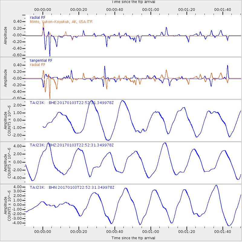
I23K Minto, Yukon-Koyukuk, AK, USA - Earthquake Result Viewer
*The percent match for this event was below the threshold and hence no stack was calculated.
| Earthquake location: |
South Of Fiji Islands |
| Earthquake latitude/longitude: |
-19.1/176.2 |
| Earthquake time(UTC): |
2017/01/03 (003) 22:40:12 GMT |
| Earthquake Depth: |
10 km |
| Earthquake Magnitude: |
5.8 mb |
| Earthquake Catalog/Contributor: |
NEIC PDE/us |
|
| Network: |
TA USArray Transportable Network (new EarthScope stations) |
| Station: |
I23K Minto, Yukon-Koyukuk, AK, USA |
| Lat/Lon: |
65.15 N/149.36 W |
| Elevation: |
149 m |
|
| Distance: |
88.0 deg |
| Az: |
13.835 deg |
| Baz: |
212.341 deg |
| Ray Param: |
$rayparam |
*The percent match for this event was below the threshold and hence was not used in the summary stack. |
|
| Radial Match: |
88.86769 % |
| Radial Bump: |
395 |
| Transverse Match: |
72.2976 % |
| Transverse Bump: |
379 |
| SOD ConfigId: |
11737051 |
| Insert Time: |
2019-04-26 12:57:18.914 +0000 |
| GWidth: |
2.5 |
| Max Bumps: |
400 |
| Tol: |
0.001 |
|
Signal To Noise
| Channel | StoN | STA | LTA |
| TA:I23K: :BHZ:20170103T22:52:31.349978Z | 1.6519507 | 3.7261118E-6 | 2.255583E-6 |
| TA:I23K: :BHN:20170103T22:52:31.349978Z | 0.428689 | 6.878024E-7 | 1.6044321E-6 |
| TA:I23K: :BHE:20170103T22:52:31.349978Z | 1.5240788 | 1.3653273E-6 | 8.9583773E-7 |
| Arrivals |
| Ps | |
| PpPs | |
| PsPs/PpSs | |


