MUR Murrieta - Earthquake Result Viewer
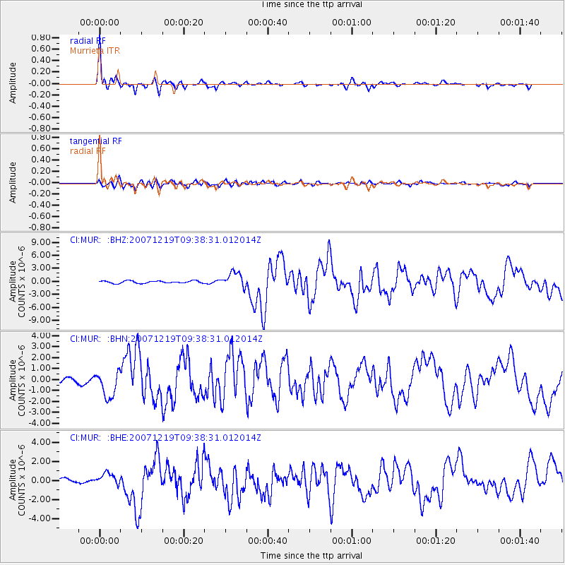
Earthquake location: Andreanof Islands, Aleutian Is.
Earthquake latitude/longitude: 51.4/-179.5
Earthquake time(UTC): 2007/12/19 (353) 09:30:27 GMT
Earthquake Depth: 29 km
Earthquake Magnitude: 6.4 MB, 7.1 MS, 7.1 MW, 7.0 MW
Earthquake Catalog/Contributor: WHDF/NEIC
Network: CI Caltech Regional Seismic Network
Station: MUR Murrieta
Lat/Lon: 33.60 N/117.20 W
Elevation: 562 m
Distance: 47.8 deg
Az: 86.644 deg
Baz: 311.42 deg
Ray Param: 0.06972887
Estimated Moho Depth: 22.0 km
Estimated Crust Vp/Vs: 2.09
Assumed Crust Vp: 6.264 km/s
Estimated Crust Vs: 2.993 km/s
Estimated Crust Poisson's Ratio: 0.35
Radial Match: 94.06609 %
Radial Bump: 351
Transverse Match: 70.968994 %
Transverse Bump: 400
SOD ConfigId: 2564
Insert Time: 2010-03-05 21:15:07.626 +0000
GWidth: 2.5
Max Bumps: 400
Tol: 0.001

Signal To Noise

ChannelStoNSTALTA
CI:MUR: :BHN:20071219T09:38:31.012014Z6.8896811.211229E-61.7580335E-7
CI:MUR: :BHE:20071219T09:38:31.012014Z1.27011296.522826E-75.135627E-7
CI:MUR: :BHZ:20071219T09:38:31.012014Z6.66922471.7629302E-62.643381E-7
Arrivals
Ps4.0 SECOND
PpPs10 SECOND
PsPs/PpSs14 SECOND