You are here: Home > Network List > CN - Canadian National Seismograph Network Stations List
> Station INK INUVIK, NT > Earthquake Result Viewer
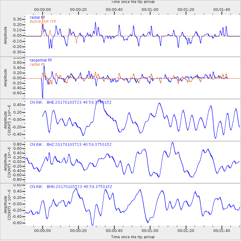
INK INUVIK, NT - Earthquake Result Viewer
*The percent match for this event was below the threshold and hence no stack was calculated.
| Earthquake location: |
Fiji Islands Region |
| Earthquake latitude/longitude: |
-18.9/176.3 |
| Earthquake time(UTC): |
2017/01/03 (003) 23:34:11 GMT |
| Earthquake Depth: |
10 km |
| Earthquake Magnitude: |
5.6 mb |
| Earthquake Catalog/Contributor: |
NEIC PDE/us |
|
| Network: |
CN Canadian National Seismograph Network |
| Station: |
INK INUVIK, NT |
| Lat/Lon: |
68.31 N/133.53 W |
| Elevation: |
44 m |
|
| Distance: |
94.2 deg |
| Az: |
16.648 deg |
| Baz: |
226.837 deg |
| Ray Param: |
$rayparam |
*The percent match for this event was below the threshold and hence was not used in the summary stack. |
|
| Radial Match: |
39.546654 % |
| Radial Bump: |
400 |
| Transverse Match: |
56.669434 % |
| Transverse Bump: |
400 |
| SOD ConfigId: |
11737051 |
| Insert Time: |
2019-04-26 13:01:22.649 +0000 |
| GWidth: |
2.5 |
| Max Bumps: |
400 |
| Tol: |
0.001 |
|
Signal To Noise
| Channel | StoN | STA | LTA |
| CN:INK: :BHZ:20170103T23:46:59.375015Z | 1.2158625 | 2.0178854E-7 | 1.6596329E-7 |
| CN:INK: :BHN:20170103T23:46:59.375015Z | 0.889914 | 2.805327E-7 | 3.1523575E-7 |
| CN:INK: :BHE:20170103T23:46:59.375015Z | 3.0376859 | 5.183028E-7 | 1.7062422E-7 |
| Arrivals |
| Ps | |
| PpPs | |
| PsPs/PpSs | |


