You are here: Home > Network List > TA - USArray Transportable Network (new EarthScope stations) Stations List
> Station G23K Bananza Creek, AK, USA > Earthquake Result Viewer
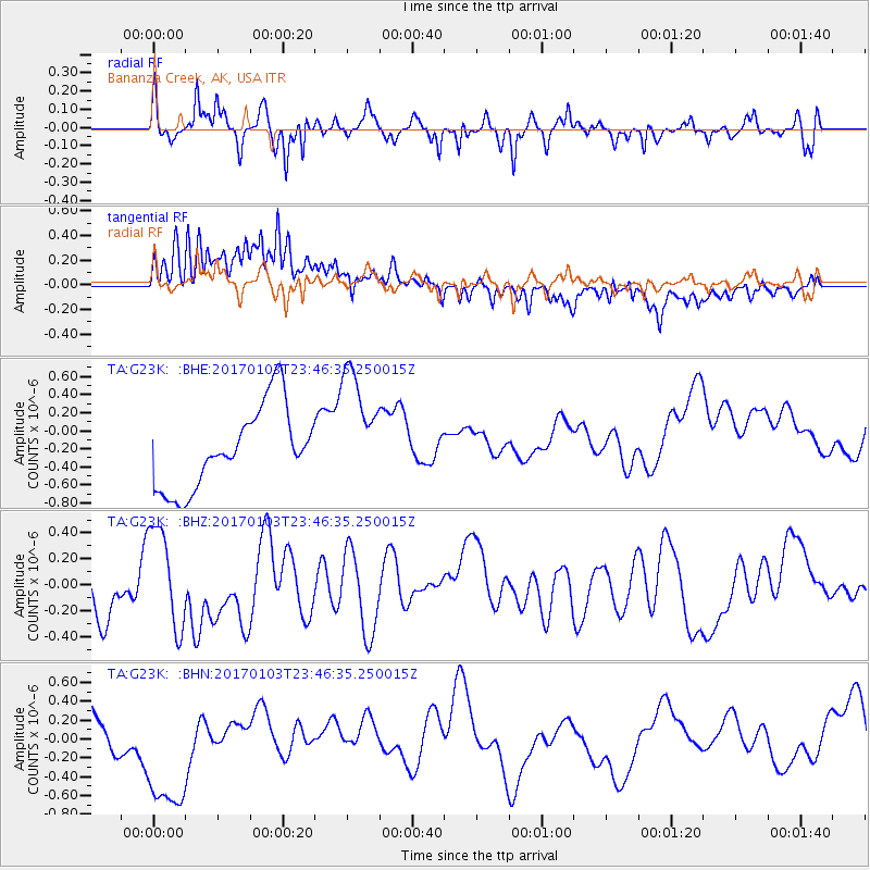
G23K Bananza Creek, AK, USA - Earthquake Result Viewer
*The percent match for this event was below the threshold and hence no stack was calculated.
| Earthquake location: |
Fiji Islands Region |
| Earthquake latitude/longitude: |
-18.9/176.3 |
| Earthquake time(UTC): |
2017/01/03 (003) 23:34:11 GMT |
| Earthquake Depth: |
10 km |
| Earthquake Magnitude: |
5.6 mb |
| Earthquake Catalog/Contributor: |
NEIC PDE/us |
|
| Network: |
TA USArray Transportable Network (new EarthScope stations) |
| Station: |
G23K Bananza Creek, AK, USA |
| Lat/Lon: |
66.71 N/150.02 W |
| Elevation: |
746 m |
|
| Distance: |
89.0 deg |
| Az: |
12.752 deg |
| Baz: |
211.703 deg |
| Ray Param: |
$rayparam |
*The percent match for this event was below the threshold and hence was not used in the summary stack. |
|
| Radial Match: |
58.616234 % |
| Radial Bump: |
378 |
| Transverse Match: |
67.54539 % |
| Transverse Bump: |
400 |
| SOD ConfigId: |
11737051 |
| Insert Time: |
2019-04-26 13:03:18.224 +0000 |
| GWidth: |
2.5 |
| Max Bumps: |
400 |
| Tol: |
0.001 |
|
Signal To Noise
| Channel | StoN | STA | LTA |
| TA:G23K: :BHZ:20170103T23:46:35.250015Z | 1.0233555 | 3.852384E-7 | 3.764463E-7 |
| TA:G23K: :BHN:20170103T23:46:35.250015Z | 3.4303987 | 7.7974573E-7 | 2.273047E-7 |
| TA:G23K: :BHE:20170103T23:46:35.250015Z | 1.4839418 | 6.666042E-7 | 4.4921183E-7 |
| Arrivals |
| Ps | |
| PpPs | |
| PsPs/PpSs | |


